Apache Pizza
Apache Pizza is a takeaway in the town in Athenry, County Galway, 134 m west of the Square. The kitchen is listed as pizza. Brady's Butcher, The Shopping Basket and Church St. Barbers are within 37 m.
- Kind
- Takeaways
- From the Square
- 134 m west
- Phone
- +353 91 845 856
- Parking
- Athenry Station Car Park on Station Road, 178 m away
- Bus stop
- The Arch Athenry, 243 m away
The map does not yet record a website or opening hours for Apache Pizza. Anyone can add them on OpenStreetMap; this page picks the change up at the next refresh.
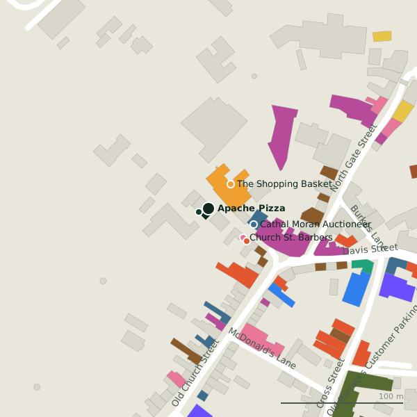
Plan of the surrounding 300 m
Getting to Apache Pizza
- By car
- Park at Athenry Station Car Park on Station Road, 178 m away, paid, 150 spaces. Athenry is 20 km from Galway city.
- By bus
- The nearest stop is The Arch Athenry, 243 m away.
- Directions from where you are
- Open the model above, tap the pin and choose “Directions here”; the route is drawn from your own position.
While you are there
22 places to eat and drink within 300 m: The Nook (41 m), Mediterraneo (48 m), J. Glynn (Bridgee's) (58 m) and J. Glynn (64 m) and more.
15 shops within 300 m, including The Shopping Basket, Athenry Antiques and Declan Rooney.
Within a short walk
- Brady's Butcher8 mButchers
- The Shopping Basket27 mConvenience stores
- Church St. Barbers37 mHairdressers
- Cathal Moran Auctioneer39 mEstate agents
- The Nook41 mCafés
- Mediterraneo48 mRestaurants
- 58 m
- Athenry Antiques59 mAntiques
Other takeaways in Athenry
- Supermac's116 mBurkes Lane
- Luca's177 mMarket Street
Questions people ask
Where is Apache Pizza?
How do I contact Apache Pizza?
Are there other takeaways nearby?
Source record: OpenStreetMap node/9995425416, read on 2026-09-18. The street is the mapped address where there is one, otherwise the nearest named road. Distances are straight lines.