Athenry Fire Station
Athenry Fire Station is a fire station on Old Church Street in Athenry, County Galway, 228 m south-west of the Square. Athenry Library, Kelly Veterinary Clinic and Athenry Credit Union are within 34 m.
- Kind
- Fire station
- Street
- Old Church Street
- From the Square
- 228 m south-west
- Run by
- Galway Fire Service
- Parking
- Backlawn Parking Lot, 98 m away
- Bus stop
- Athenry Shopping Centre, 422 m away
The map does not yet record a phone number, a website or opening hours for Athenry Fire Station. Anyone can add them on OpenStreetMap; this page picks the change up at the next refresh.
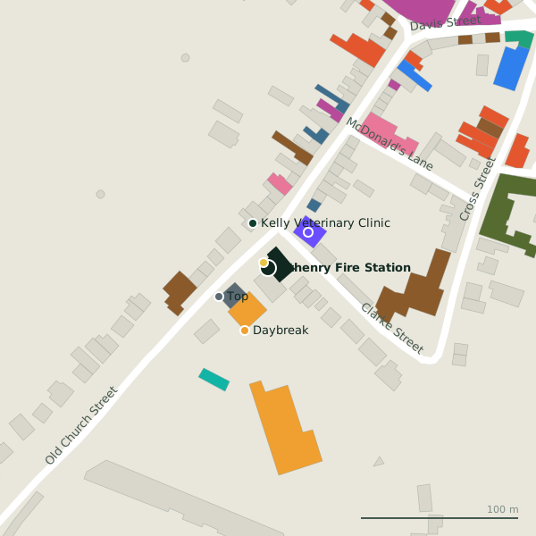
Plan of the surrounding 300 m
Getting to Athenry Fire Station
- By car
- Park at Backlawn Parking Lot, 98 m away, paid, 133 spaces. Athenry is 20 km from Galway city.
- By bus
- The nearest stop is Athenry Shopping Centre, 422 m away.
- Directions from where you are
- Open the model above, tap the pin and choose “Directions here”; the route is drawn from your own position.
While you are there
23 places to eat and drink within 300 m: Hanberry’s Bar & Lounge (62 m), The Fields Bar (83 m), The Park Bar (104 m) and Papa Rich (151 m) and more.
14 shops within 300 m, including Daybreak, Aldi and NCBI Charity Shop.
Old Church Street itself has 35 named places on the map, and 1 car park along it.
Within a short walk
- Athenry Library4 mLibrary
- 30 m
- Athenry Credit Union34 mBanks
- Top36 mPetrol stations
- Daybreak42 mConvenience stores
- Gadget Tech & Office Supplies45 mStationery
- Farrell Insurance & Auctioneers49 mInsurance
- Time for nails!52 mBeauty
Also on Old Church Street
- AmicitaVisitor information
- Athenry AntiquesAntiques
- Athenry Family Dental PracticeDentists
- Athenry LibraryLibrary
- Cathal Moran AuctioneerEstate agents
- ChinatownRestaurants
- Church St. BarbersHairdressers
- Ciaran Cannon Constituency OfdixePolitician
Everything on Old Church Street (35 places)
Questions people ask
Where is Athenry Fire Station?
Source record: OpenStreetMap way/178054685, read on 2026-09-18. The street is the mapped address where there is one, otherwise the nearest named road. Distances are straight lines.