Crowe’s Bar
Crowe’s Bar is a pub on North Gate Street in Athenry, County Galway, on the Square. Dan’s Bar, The Skillet Inn and La Pause Dessert are within 44 m.
- Kind
- Pubs
- Street
- North Gate Street
- From the Square
- On the Square
- Parking
- Athenry Town on North Gate Street, 141 m away
- Bus stop
- The Arch Athenry, 169 m away
The map does not yet record a phone number, a website or opening hours for Crowe’s Bar. Anyone can add them on OpenStreetMap; this page picks the change up at the next refresh.
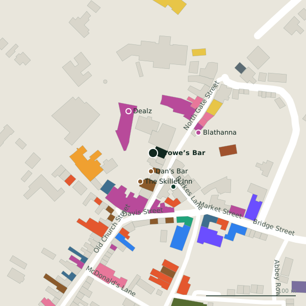
Plan of the surrounding 300 m
Getting to Crowe’s Bar
- By car
- Park at Athenry Town on North Gate Street, 141 m away, paid, 23 spaces. Athenry is 20 km from Galway city.
- By bus
- The nearest stop is The Arch Athenry, 169 m away.
- Directions from where you are
- Open the model above, tap the pin and choose “Directions here”; the route is drawn from your own position.
While you are there
21 places to eat and drink within 300 m: Dan’s Bar (20 m), The Skillet Inn (35 m), La Rustica (58 m) and Supermac's (58 m) and more.
14 shops within 300 m, including Dealz, This & That and Blathanna.
North Gate Street itself has 11 named places on the map, and 1 car park along it.
Within a short walk
- Dan’s Bar20 mPubs
- The Skillet Inn35 mPubs
- La Pause Dessert44 mBakeries
- Dealz54 mVariety stores
- Blathanna55 mFlorists
- This & That55 mVariety stores
- La Rustica58 mRestaurants
- Supermac's58 mTakeaways
Also on North Gate Street
- Beauty SalonBeauty
- BlathannaFlorists
- Dan’s BarPubs
- La RusticaRestaurants
- Peggi Browne InteriorsInterior decoration
- Presentation PrimarySchools
- Quick CutzHairdressers
Everything on North Gate Street (11 places)
Other pubs in Athenry
- Dan’s Bar20 mNorth Gate Street
- The Skillet Inn35 mNorth Gate Street
- The Hop Inn80 mDavis Street
- The Central Bar81 mDavis Street
- J. Glynn (Bridgee's)82 mOld Church Street
- J. Glynn87 mOld Church Street
- The Square Inn100 mCross Street
- The Fields Bar184 mOld Church Street
Questions people ask
Where is Crowe’s Bar?
Are there other pubs nearby?
Source record: OpenStreetMap way/692182904, read on 2026-09-18. The street is the mapped address where there is one, otherwise the nearest named road. Distances are straight lines.