Gyms · The Willows · Athenry
Kardio Kids
Kardio Kids is a gym on The Willows in Athenry, County Galway, 997 m west of the Square. Tranquility Spa, Tranquility Leisure and McHale’s Bar are within 40 m.
- Kind
- Gyms
- Street
- The Willows
- From the Square
- 997 m west
- Phone
- +353 91 875 300
- Wheelchair
- Accessible
- Parking
- Athenry Station Car Park on Station Road, 717 m away
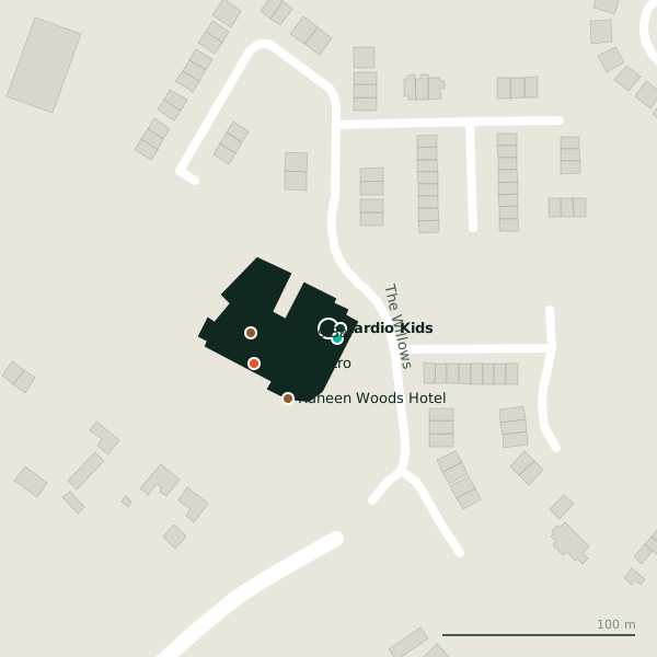
The building in black is this one; drag to turn the model.Open the whole town
Plan of the surrounding 300 m
Getting to Kardio Kids
- By car
- Park at Athenry Station Car Park on Station Road, 717 m away, paid, 150 spaces. Athenry is 20 km from Galway city.
- Directions from where you are
- Open the model above, tap the pin and choose “Directions here”; the route is drawn from your own position.
While you are there
2 places to eat and drink within 300 m: McHale’s Bar (41 m) and Clarin Bistro (43 m).
The Willows itself has 3 named places on the map.
It is open on Sundays (10:00-19:00), which not every place in the town is.
Opening hours
- Mon
- Not recorded
- Tue
- Not recorded
- Wed
- 10:00-19:00
- Thu
- 10:00-19:00
- Fri
- 10:00-19:00
- Sat
- 10:00-19:00
- Sun
- 10:00-19:00
As recorded on OpenStreetMap on 2026-09-18; bank holidays may differ.
Within a short walk
- Tranquility Spa6 mCosmetics
- 7 m
- McHale’s Bar40 mBars
- Raheen Woods Hotel42 mHotels
- Clarin Bistro43 mRestaurants
Also on The Willows
- Tranquility SpaCosmetics
Other gyms in Athenry
- Tranquility Leisure7 mThe Willows
- 569 m
- Target Fitness881 mOld Church Street
Questions people ask
Where is Kardio Kids?
On The Willows in Athenry, 997 m west of the Square; the nearest car park is 717 m away.
When is Kardio Kids open?
The map records We-Su 10:00-19:00. The table above shows it day by day, and the badge at the top says whether it is open at this moment.
How do I contact Kardio Kids?
By phone on +353 91 875 300, or through tranquillityleisureandspa.com.
Are there other gyms nearby?
3 other gyms in $Athenry; the closest is Tranquility Leisure, 7 m away.
Source record: OpenStreetMap node/5046988021, read on 2026-09-18. The street is the mapped address where there is one, otherwise the nearest named road. Distances are straight lines.