residential street · $Athenry, County Galway
Stonehaven
Stonehaven is a residential street in Athenry, 1.4 km north-east of the Square. It is 164 m long, about 2 minutes on foot end to end.
- Type
- Residential street
- Length
- 164 m of mapped road
- From the Square
- 1.4 km north-east
- Nearest bus stop
- Londis Tuam Road Athenry, 1.1 km away
- Nearest parking
- Athenry Town on North Gate Street, 1.2 km away
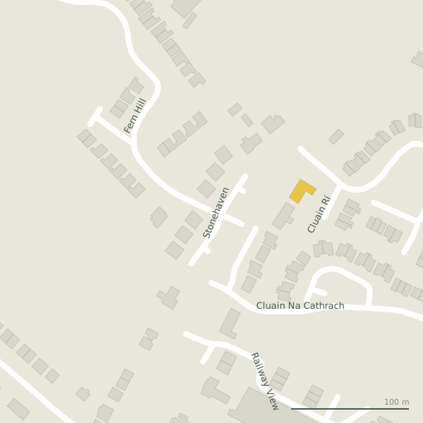
The street is drawn in black; buildings are coloured by what is in them. Drag to turn the model, tap a pin for the place.
Plan of the street
Questions people ask
Where is Stonehaven?
In Athenry, County Galway, 1.4 km north-east of the Square.
How long is Stonehaven?
164 m, measured along the mapped centre line; about 2 minutes on foot end to end.
Is there a bus stop on Stonehaven?
Not on the street itself; the nearest on the map is Londis Tuam Road Athenry on Cullairbaun, 1.1 km from the middle of the street.
Where can I park near Stonehaven?
The nearest car park is Athenry Town on North Gate Street, 1.2 km away.
Browse by kind
Geometry, names and places from OpenStreetMap, read on 2026-09-18. Length is the sum of the mapped segments carrying this name; distances are straight lines from the street's midpoint.