Vaughan’s
Vaughan’s is a pub on Market Street in Clifden, County Galway, 168 m south-east of Market Square. Vaughan's B&B, Creeve House B&B and Stanleys are within 31 m.
- Kind
- Pubs
- Street
- Market Street
- From Market Square
- 168 m south-east
- Parking
- Clifden Coach Park, 237 m away
- Bus stop
- Clifden (Library), 82 m away
The map does not yet record a phone number, a website or opening hours for Vaughan’s. Anyone can add them on OpenStreetMap; this page picks the change up at the next refresh.
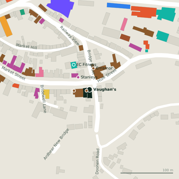
Plan of the surrounding 300 m
Getting to Vaughan’s
- By car
- Park at Clifden Coach Park, 237 m away, 6 spaces. Clifden is 69 km from Galway city.
- By bus
- The nearest stop is Clifden (Library), 82 m away, with a shelter.
- Directions from where you are
- Open the model above, tap the pin and choose “Directions here”; the route is drawn from your own position.
While you are there
23 places to eat and drink within 300 m: Mannion’s (114 m), Steam Coffee House (139 m), Jasmine Garden (140 m) and Signal Bar (141 m) and more.
25 shops within 300 m, including Stanleys, Love Vintage and Clifden Bike Shop.
Market Street itself has 26 named places on the map.
Within a short walk
- Vaughan's B&B6 mGuest houses
- Creeve House B&B30 mGuest houses
- Stanleys31 mOutdoor shops
- Errismor41 mGuest houses
- EC Fitness56 mGyms
- Dún Rí Guest House68 mGuest houses
- The Lodge80 mGuest houses
- Public Library82 mLibrary
Also on Market Street
- Clifden Bike ShopBike shops
- Connemara Holiday LettingsTravel agency
- CoylesCafés
- Creeve House B&BGuest houses
- Derval JoyceGift shops
- Derval Woollen MillsClothes shops
- Golden GlowBeauty
- Jasmine GardenRestaurants
Everything on Market Street (26 places)
Other pubs in Clifden
- Mannion’s114 mMarket Street
- Signal Bar141 mGalway Road
- Lowry’s185 mMarket Square
- Griffin’s208 mMain Street
- Ravi’s Bar and Resturant217 mMarket Street
- Tom King’s Bar & Snug227 mMarket Square
- Guy’s Bar232 mMain Street
- E.J. Kings Bar & Restaurant247 mMain Street
Questions people ask
Where is Vaughan’s?
Are there other pubs nearby?
Source record: OpenStreetMap node/1809984777, read on 2026-09-18. The street is the mapped address where there is one, otherwise the nearest named road. Distances are straight lines.