Clothes shops · Caher Court · Loughrea
Celtic Couture
Celtic Couture is a clothes shop on Caher Court in Loughrea, County Galway, 1.1 km east of the centre. Aqua-Mer, Eyre Chiropractic Clinic Limited and Study Hub are within 17 m.
- Kind
- Clothes shops
- Street
- Caher Court
- From the centre
- 1.1 km east
- Parking
- O'Dea's Hotel Car Park on The Crescent, 750 m away
The map does not yet record a phone number, a website or opening hours for Celtic Couture. Anyone can add them on OpenStreetMap; this page picks the change up at the next refresh.
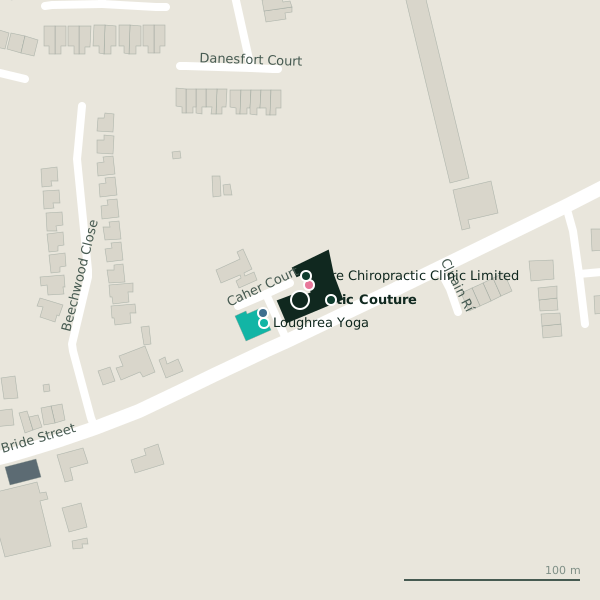
The building in black is this one; drag to turn the model.Open the whole town
Plan of the surrounding 300 m
Getting to Celtic Couture
- By car
- Park at O'Dea's Hotel Car Park on The Crescent, 750 m away, paid. Loughrea is 33 km from Galway city.
- Directions from where you are
- Open the model above, tap the pin and choose “Directions here”; the route is drawn from your own position.
While you are there
1 shop within 300 m, including Spar.
Caher Court itself has 4 named places on the map.
Within a short walk
- Aqua-Mer10 mBeauty
- Eyre Chiropractic Clinic Limited14 mAlternative
- Study Hub17 mEducational institution
- RGR partners22 mAccountants
- Loughrea Yoga24 mGyms
- Brodricks178 mPetrol stations
- Loughrea GAA Club182 mSports centres
- St. Brendan's Park198 mPitches
Also on Caher Court
- Aqua-MerBeauty
- Eyre Chiropractic Clinic LimitedAlternative
- RGR partnersAccountants
Other clothes shops in Loughrea
- Penny Lane938 mMain Street
- Pia958 mMain Street
- Martin Fahy992 mMain Street
- Bernard Dervan & Co1.1 kmMain Street
- Lily1.2 kmMain Street
- The Daisy Chain1.2 kmCastle Street
Questions people ask
Where is Celtic Couture?
On Caher Court in Loughrea, 1.1 km east of the centre; the nearest car park is 750 m away.
Are there other clothes shops nearby?
6 other clothes shops in $Loughrea; the closest is Penny Lane, 938 m away.
Source record: OpenStreetMap node/2053523563, read on 2026-09-18. The street is the mapped address where there is one, otherwise the nearest named road. Distances are straight lines.