Hair Design
Hair Design is a hairdresser on Abbey Street in Loughrea, County Galway, 192 m north-west of the centre. Waves Hair Salon, Gerards Hair Salon and Denis Healy Dental Surgeon are within 32 m.
- Kind
- Hairdressers
- Street
- Abbey Street
- From the centre
- 192 m north-west
- Parking
- Short Term Car Park, 281 m away
- Bus stop
- Loughrea (Bus Éireann), 206 m away
The map does not yet record a phone number, a website or opening hours for Hair Design. Anyone can add them on OpenStreetMap; this page picks the change up at the next refresh.
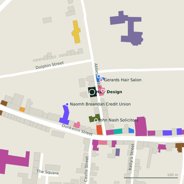
Plan of the surrounding 300 m
Getting to Hair Design
- By car
- Park at Short Term Car Park, 281 m away, paid, 117 spaces. Loughrea is 33 km from Galway city.
- By bus
- The nearest stop is Loughrea, served by Bus Éireann, 206 m away.
- Directions from where you are
- Open the model above, tap the pin and choose “Directions here”; the route is drawn from your own position.
While you are there
16 places to eat and drink within 300 m: Amigo's Ristorante (72 m), Dawdy Kenny’s;Dawdy Kenny's (87 m), Madden’s (91 m) and Knights Inn (161 m) and more.
23 shops within 300 m, including Power Sports, Lily and The Daisy Chain.
Abbey Street itself has 7 named places on the map, and 1 car park along it.
Within a short walk
- Waves Hair Salon20 mHairdressers
- Gerards Hair Salon28 mHairdressers
- Denis Healy Dental Surgeon32 mDentists
- 51 m
- John Nash Solicitors52 mSolicitors
- Amigo's Ristorante72 mRestaurants
- The Beauty Bee72 mBeauty
- Power Sports83 mSports shops
Also on Abbey Street
- Denis Healy Dental SurgeonDentists
- Gerards Hair SalonHairdressers
- John Nash SolicitorsSolicitors
- Loughrea FET CentreEducational institution
- The Haverty Education CentreColleges
- Waves Hair SalonHairdressers
Other hairdressers in Loughrea
- Waves Hair Salon20 mAbbey Street
- Gerards Hair Salon28 mAbbey Street
- Top Knots90 mDunkellin Street
- H & B Barbers94 mMain Street
- Barbour384 mBride Street
Questions people ask
Where is Hair Design?
Are there other hairdressers nearby?
Source record: OpenStreetMap node/1419741840, read on 2026-09-18. The street is the mapped address where there is one, otherwise the nearest named road. Distances are straight lines.