Murphys XL
Murphys XL is a convenience store on The Crescent in Loughrea, County Galway, 436 m north-east of the centre. Maggie Mays, Brodericks and Loughrea School & Office Supplies are within 175 m.
- Street
- The Crescent
- From the centre
- 436 m north-east
- Parking
- O'Dea's Hotel Car Park on The Crescent, 80 m away
- Bus stop
- Loughrea (Bus Éireann), 274 m away
The map does not yet record a phone number, a website or opening hours for Murphys XL. Anyone can add them on OpenStreetMap; this page picks the change up at the next refresh.
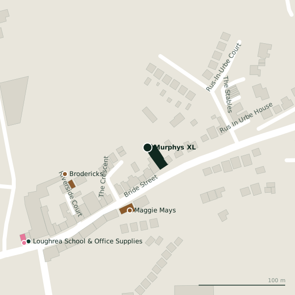
Plan of the surrounding 300 m
Getting to Murphys XL
- By car
- Park at O'Dea's Hotel Car Park on The Crescent, 80 m away, paid. Loughrea is 33 km from Galway city.
- By bus
- The nearest stop is Loughrea, served by Bus Éireann, 274 m away.
- Directions from where you are
- Open the model above, tap the pin and choose “Directions here”; the route is drawn from your own position.
While you are there
4 places to eat and drink within 300 m: Maggie Mays (75 m), Subway (192 m), Il Porcetto (271 m) and The Weavers Rest (287 m).
9 shops within 300 m, including Cunnane, Beattys Topline Hardware and iPhone Master.
Within a short walk
- Maggie Mays75 mPubs
- Brodericks100 mHotels
- Loughrea School & Office Supplies175 mStationery
- Barbour179 mHairdressers
- St Bridget's Well186 mHoly wells
- Subway192 mTakeaways
- Kilboys Funeral Directors LTD203 mFuneral directors
- Loughrea Mart219 mLivestock
Other convenience stores in Loughrea
- O'Reilly's Newsagents391 mChurch Street
- Spar451 mBride Street
- 798 m
- Spar1.4 kmLoughrea Plaza
Questions people ask
Where is Murphys XL?
Are there other convenience stores nearby?
Source record: OpenStreetMap way/841971097, read on 2026-09-18. The street is the mapped address where there is one, otherwise the nearest named road. Distances are straight lines.