Pat Loughnane & Sons
Pat Loughnane & Sons is a butcher on Main Street in Loughrea, County Galway, 122 m north-east of the centre. Martin Fahy, Donlon's Fruit & Veg and Mai Asian Streetfood are within 19 m.
- Kind
- Butchers
- Street
- Main Street
- From the centre
- 122 m north-east
- Wheelchair
- Accessible
- Parking
- Short Term Car Park, 49 m away
- Bus stop
- Loughrea (Bus Éireann), 50 m away
The map does not yet record a phone number, a website or opening hours for Pat Loughnane & Sons. Anyone can add them on OpenStreetMap; this page picks the change up at the next refresh.
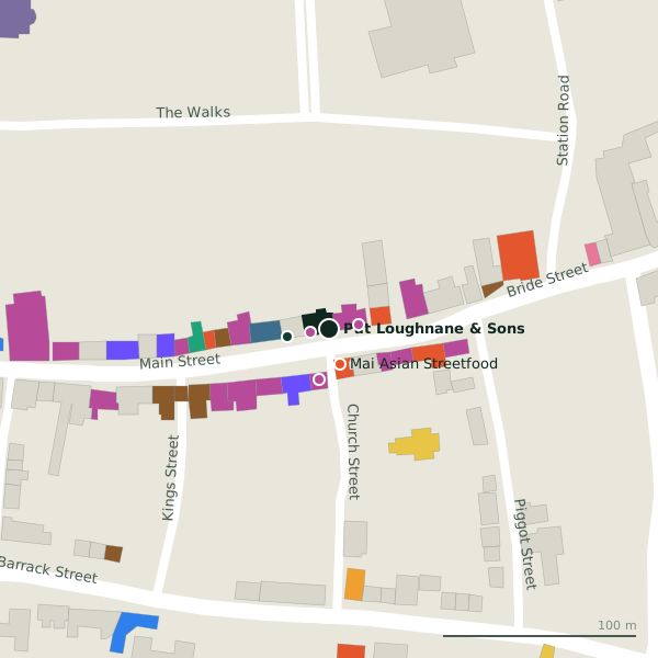
Plan of the surrounding 300 m
Getting to Pat Loughnane & Sons
- By car
- Park at Short Term Car Park, 49 m away, paid, 117 spaces. Loughrea is 33 km from Galway city.
- By bus
- The nearest stop is Loughrea, served by Bus Éireann, 50 m away.
- Directions from where you are
- Open the model above, tap the pin and choose “Directions here”; the route is drawn from your own position.
While you are there
17 places to eat and drink within 300 m: Mai Asian Streetfood (19 m), Charlie’s Bar (28 m), The Weavers Rest (29 m) and John Patrick’s (32 m) and more.
23 shops within 300 m, including Martin Fahy, Donlon's Fruit & Veg and Vodafone.
Main Street itself has 50 named places on the map, and 1 car park along it.
Within a short walk
- Martin Fahy10 mClothes shops
- Donlon's Fruit & Veg15 mGreengrocers
- Mai Asian Streetfood19 mRestaurants
- Hopes Bakery & Coffee Shop22 mBakeries
- Vodafone26 mPhone shops
- Charlie’s Bar28 mPubs
- The Weavers Rest29 mRestaurants
- John Patrick’s32 mPubs
Also on Main Street
- AIBBanks
- Ara Dry CleanersDry cleaners
- Bank of IrelandBanks
- BeattyJewellers
- BeattysDepartment stores
- Bernard Dervan & CoClothes shops
- Billy's Discount StoreVariety stores
- BrogansPharmacies
Everything on Main Street (50 places)
Questions people ask
Where is Pat Loughnane & Sons?
Source record: OpenStreetMap node/1257321515, read on 2026-09-18. The street is the mapped address where there is one, otherwise the nearest named road. Distances are straight lines.