Portumna Community Hall
Portumna Community Hall is a community centre on Clonfert Avenue in Portumna, County Galway, on the centre. Cafe Rose, NCBI and Bank of Ireland are within 71 m.
- Street
- Clonfert Avenue
- From the centre
- On the centre
- Parking
- SuperValu Car Park, 149 m away
- Bus stop
- Portumna, 275 m away
The map does not yet record a phone number, a website or opening hours for Portumna Community Hall. Anyone can add them on OpenStreetMap; this page picks the change up at the next refresh.
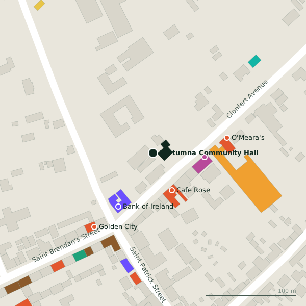
Plan of the surrounding 300 m
Getting to Portumna Community Hall
- By car
- Park at SuperValu Car Park, 149 m away. Portumna is 59 km from Galway city.
- By bus
- The nearest stop is Portumna, 275 m away.
- Directions from where you are
- Open the model above, tap the pin and choose “Directions here”; the route is drawn from your own position.
While you are there
10 places to eat and drink within 300 m: Cafe Rose (47 m), O'Meara's (84 m), Golden City (105 m) and Horan's Corner House (112 m) and more.
3 shops within 300 m, including NCBI, SuperValu and D. Lynch & Sons Ltd..
Clonfert Avenue itself has 7 named places on the map, and 1 car park along it.
Within a short walk
- Cafe Rose47 mCafés
- NCBI57 mCharity shops
- Bank of Ireland71 mBanks
- O'Meara's84 mRestaurants
- Golden City105 mRestaurants
- SuperValu105 mSupermarkets
- 111 m
- Portumna Post Office125 mPost office
Also on Clonfert Avenue
- Bank of IrelandBanks
- Cafe RoseCafés
- NCBICharity shops
- O'Meara'sRestaurants
- SuperValuSupermarkets
- The Muscle MillGyms
Questions people ask
Where is Portumna Community Hall?
Source record: OpenStreetMap way/191740298, read on 2026-09-18. The street is the mapped address where there is one, otherwise the nearest named road. Distances are straight lines.