Ceardlann - Spiddal Craft Village
Ceardlann - Spiddal Craft Village is a shopping centre on Cois Trá in Spiddal, County Galway, 296 m east of the pier. Cló Iar-Chonnacht - Book Shop, The Irish T-Shirt shop and Ceardlann síodchló (screen-print workshop) are within 64 m.
- Kind
- Shopping centres
- Street
- Cois Trá
- From the pier
- 296 m east
- Website
- spiddalcrafts.com
- Parking
- Céibh An Spidéil on Bóthar na Céibhe, 735 m away
- Bus stop
- Stop (Bus Éireann), 328 m away
The map does not yet record a phone number or opening hours for Ceardlann - Spiddal Craft Village. Anyone can add them on OpenStreetMap; this page picks the change up at the next refresh.
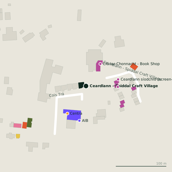
Plan of the surrounding 300 m
Getting to Ceardlann - Spiddal Craft Village
- By car
- Park at Céibh An Spidéil on Bóthar na Céibhe, 735 m away, 40 spaces. Spiddal is 17 km from Galway city.
- By bus
- The nearest stop is an unnamed stop, served by Bus Éireann, 328 m away.
- Directions from where you are
- Open the model above, tap the pin and choose “Directions here”; the route is drawn from your own position.
While you are there
4 places to eat and drink within 300 m: Builín Blasta (102 m), rúnda (142 m), Fiordigrano Pizzeria (224 m) and Tigh Hughes (279 m).
7 shops within 300 m, including Cló Iar-Chonnacht - Book Shop, The Irish T-Shirt shop and Ceardlann síodchló (screen-print workshop).
Cois Trá itself has 5 named places on the map.
Within a short walk
- Cló Iar-Chonnacht - Book Shop52 mBookshops
- The Irish T-Shirt shop63 mGift shops
- 64 m
- Centra66 mConvenience stores
- AIB70 mCash machines
- Celtic Coin and Design Jewellery75 mJeweller
- Texaco77 mPetrol stations
- Andrea Rossi Artist84 mGift shops
Also on Cois Trá
- CentraConvenience stores
- Máirtín Ó CadhainMonuments
- Scoil ÉinneSchools
- TexacoPetrol stations
Questions people ask
Where is Ceardlann - Spiddal Craft Village?
Source record: OpenStreetMap way/1088855729, read on 2026-09-18. The street is the mapped address where there is one, otherwise the nearest named road. Distances are straight lines.