Spar
Spar is a convenience store on Bhóthar an tSléibhe in Spiddal, County Galway, on the pier. Spiddal Post Office, AIB and BoyleSports are within 19 m.
- Street
- Bhóthar an tSléibhe
- From the pier
- On the pier
- Parking
- Céibh An Spidéil on Bóthar na Céibhe, 449 m away
- Bus stop
- Stop (Bus Éireann), 32 m away
The map does not yet record a phone number, a website or opening hours for Spar. Anyone can add them on OpenStreetMap; this page picks the change up at the next refresh.
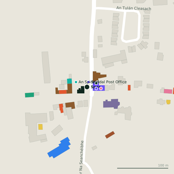
Plan of the surrounding 300 m
Getting to Spar
- By car
- Park at Céibh An Spidéil on Bóthar na Céibhe, 449 m away, 40 spaces. Spiddal is 17 km from Galway city.
- By bus
- The nearest stop is an unnamed stop, served by Bus Éireann, 32 m away.
- Directions from where you are
- Open the model above, tap the pin and choose “Directions here”; the route is drawn from your own position.
While you are there
8 places to eat and drink within 300 m: Tigh Hughes (31 m), Cois Cuain (35 m), Bláth Fiáin (48 m) and Supermac's (60 m) and more.
1 shop within 300 m, including Centra.
Bhóthar an tSléibhe itself has 10 named places on the map.
Within a short walk
- Spiddal Post Office10 mPost office
- AIB18 mBanks
- BoyleSports19 mBookmaker
- An Spidéal23 mPitches
- Síoda28 mHairdressers
- Tigh Hughes31 mPubs
- Clinic Fiaclóireachta an Spidéal35 mDentists
- Cois Cuain35 mPubs
Also on Bhóthar an tSléibhe
- AIBBanks
- An SpidéalPitches
- Ard Eoinin B&BGuest houses
- BoyleSportsBookmaker
- Clinic Fiaclóireachta an SpidéalDentists
- SíodaHairdressers
- Spiddal Garda StationGarda station
- Spiddal Post OfficePost office
Everything on Bhóthar an tSléibhe (10 places)
Other convenience stores in Spiddal
- Centra257 mCois Trá
Questions people ask
Where is Spar?
Are there other convenience stores nearby?
Source record: OpenStreetMap node/1868768712, read on 2026-09-18. The street is the mapped address where there is one, otherwise the nearest named road. Distances are straight lines.