Pharmacies · Tuam
Medwell Pharmacy
Medwell Pharmacy is a pharmacy in the town in Tuam, County Galway, 227 m west of the Square. Pedro's Cafe & Grill, Domino's Pizza and Specsavers are within 37 m.
- Kind
- Pharmacies
- From the Square
- 227 m west
- Wheelchair
- Accessible
- Parking
- The Shambles Car Park on Vicar Street, 250 m away
- Bus stop
- Tuam (Corrib Oil), 239 m away
The map does not yet record a phone number, a website or opening hours for Medwell Pharmacy. Anyone can add them on OpenStreetMap; this page picks the change up at the next refresh.
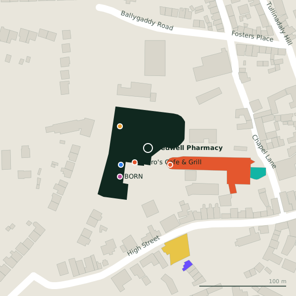
The building in black is this one; drag to turn the model.Open the whole town
Plan of the surrounding 300 m
Getting to Medwell Pharmacy
- By car
- Park at The Shambles Car Park on Vicar Street, 250 m away. Tuam is 30 km from Galway city.
- By bus
- The nearest stop is Tuam (Corrib Oil), 239 m away.
- Directions from where you are
- Open the model above, tap the pin and choose “Directions here”; the route is drawn from your own position.
While you are there
12 places to eat and drink within 300 m: Pedro's Cafe & Grill (22 m), Domino's Pizza (32 m), Apache Pizza (225 m) and The Galway Roast (239 m) and more.
13 shops within 300 m, including Tesco, BORN and Intersport Elverys.
Within a short walk
- Pedro's Cafe & Grill22 mCafés
- Domino's Pizza32 mRestaurants
- Specsavers37 mOpticians
- Tesco41 mSupermarkets
- BORN46 mClothes shops
- Intersport Elverys61 mSports shops
- Tuam Library117 mLibrary
- 131 m
Other pharmacies in Tuam
- High Cross Pharmacy196 mHigh Street
- Duffy's Pharmacy226 mThe Square
- Kilgarriff's Chemists240 mVicar Street
- Walsh's Pharmacy242 mThe Square
- Leo's Pharmacy246 mThe Square
- Gleeson Pharmacy272 mVicar Street
- Feely's Pharmacy324 mDublin Road
- Palace Fields Pharmacy820 mTullinadaly Road
Questions people ask
Where is Medwell Pharmacy?
In Tuam, County Galway, 227 m west of the Square; the nearest car park is 250 m away.
Are there other pharmacies nearby?
8 other pharmacies in $Tuam; the closest is High Cross Pharmacy, 196 m away.
Source record: OpenStreetMap node/4148057449, read on 2026-09-18. The street is the mapped address where there is one, otherwise the nearest named road. Distances are straight lines.