The Phoenix Hall Health Centre
The Phoenix Hall Health Centre is a doctor on Vicar Street in Tuam, County Galway, 171 m south of the Square. Pet Haven, Tuam Book Shop and Expert Electrical are within 23 m.
- Kind
- Doctors
- Street
- Vicar Street
- From the Square
- 171 m south
- Parking
- The Shambles Car Park on Vicar Street, 83 m away
- Bus stop
- Tuam (Vicar Street Bon Secours) (Bus Éireann), 72 m away
The map does not yet record a phone number, a website or opening hours for The Phoenix Hall Health Centre. Anyone can add them on OpenStreetMap; this page picks the change up at the next refresh.
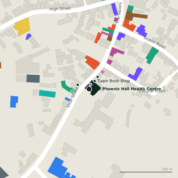
Plan of the surrounding 300 m
Getting to The Phoenix Hall Health Centre
- By car
- Park at The Shambles Car Park on Vicar Street, 83 m away. Tuam is 30 km from Galway city.
- By bus
- The nearest stop is Tuam (Vicar Street Bon Secours), served by Bus Éireann, 72 m away, with a shelter.
- Directions from where you are
- Open the model above, tap the pin and choose “Directions here”; the route is drawn from your own position.
While you are there
12 places to eat and drink within 300 m: The Connaught Arms (41 m), Golden Pizza (50 m), Apache Pizza (90 m) and The Sportsman's Inn (104 m) and more.
11 shops within 300 m, including Pet Haven, Tiny Toes and Spice of Life.
Vicar Street itself has 18 named places on the map, and 2 car parks along it.
Within a short walk
- Pet Haven9 mPet shops
- Tuam Book Shop19 mVacant
- Expert Electrical23 mElectrical
- R&B Locksmiths29 mLocksmith
- Gleeson Pharmacy33 mPharmacies
- One Step Ahead41 mHairdressers
- 41 m
- Tuam Dental47 mDentists
Also on Vicar Street
- AIBBanks
- Expert ElectricalElectrical
- Gleeson PharmacyPharmacies
- Golden PizzaRestaurants
- Kilgarriff's ChemistsPharmacies
- Off LicenceOff licences
- One Step AheadHairdressers
- Pet HavenPet shops
Everything on Vicar Street (18 places)
Other doctors in Tuam
- 144 m
Questions people ask
Where is The Phoenix Hall Health Centre?
Are there other doctors nearby?
Source record: OpenStreetMap node/6831927461, read on 2026-09-18. The street is the mapped address where there is one, otherwise the nearest named road. Distances are straight lines.