Athenry Castle
Off Court Lane on the east side of Athenry, on a rise above a ford in the River Clarin, stands the castle the town grew up around. Locals call it King John's Castle, though it went up twenty years after his reign: a squat keep of about 1235 to 1240, raised and extended by Meyler de Bermingham around 1250, and now, since its restoration in 2005, one of the county's best-kept medieval buildings.
Checked against the source on 2026-09-19.
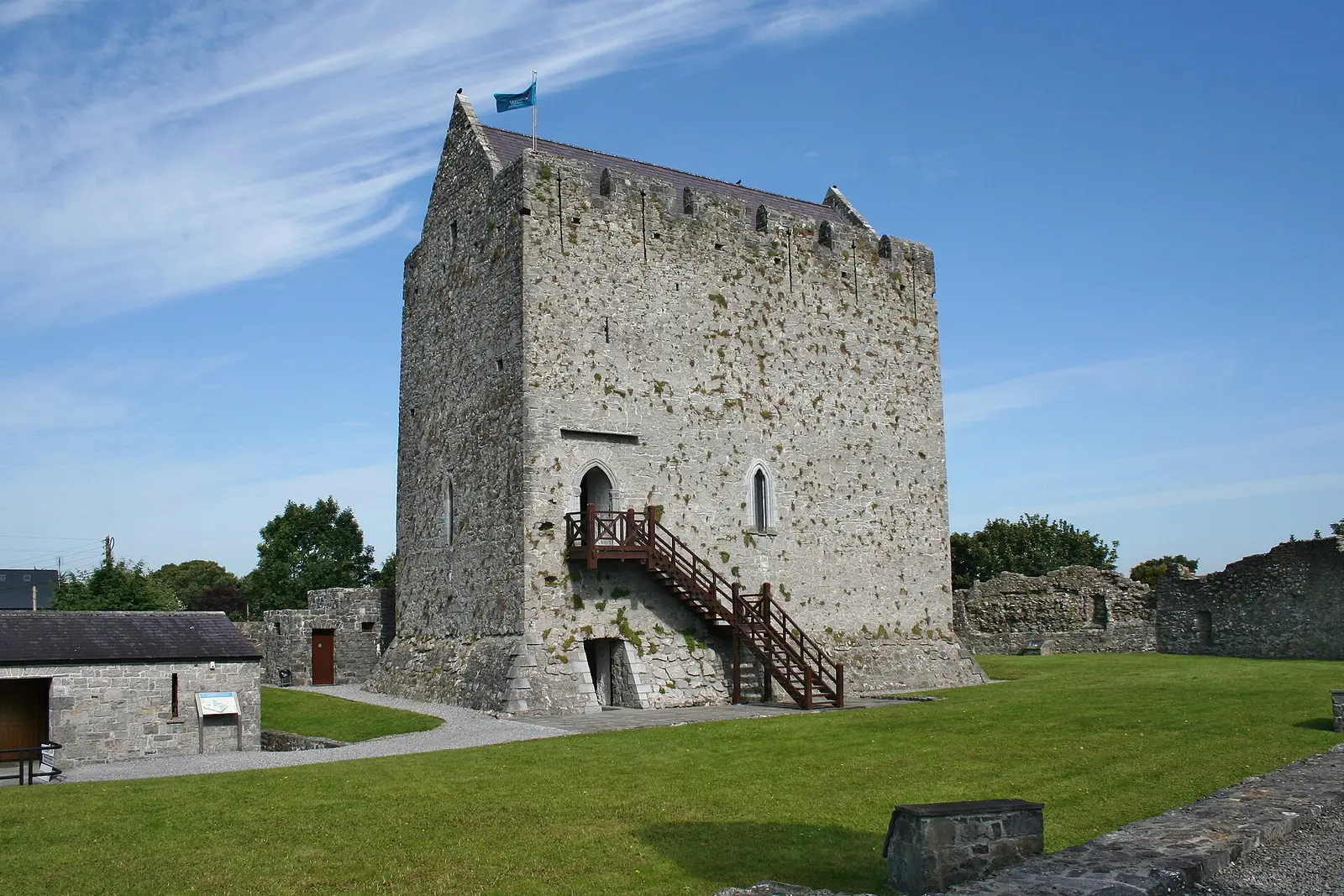
Ingo Mehling, CC BY-SA 3.0 via Wikimedia Commons

Athenry Castle on the 3D model; tap a pin for its page and directions.
A hall on a hill
The original keep was low, its roof at the level of the present second floor, with a hall on the upper floor and stores below; the entrance was at first-floor level up an external wooden stair. A brazier in the middle of the hall probably gave the heat, the smoke leaving through an opening in the roof, and the garderobe sits diagonally across from the door. The doorway and two of the windows carry fine carving, capitals with floral motifs in the local style called the School of the West, halfway between Romanesque and late Gothic. Parts of the enclosure wall survive, and a mural stair leads to the top floor.
Attacks, walls and the move to the square
The castle was attacked in 1316, and the town answered by building its walls. In the fifteenth century the Berminghams left it for a townhouse beside the market cross in the square, and the thirteenth-century battlements, with their tall arrowslits, were built into gables at the north and south ends for a new roof. In 1596, in the Nine Years' War, the castle fell to the O'Donnells.
Visiting
The castle was restored in 2005 and is a National Monument. It is a few minutes' walk from the station and the square; the priory is across the river. Kathleen Duey set a children's novel here, Hoofbeats: Lara at Athenry Castle, in 2005.
Questions people ask
How old is Athenry Castle?
Is Athenry Castle King John's Castle?
Can you visit Athenry Castle?
Written from Wikipedia, "Athenry Castle" (CC BY-SA 4.0), read on 2026-09-19, and from the OpenStreetMap places on the model. Nothing has been added from memory; follow the source for its footnotes.