Athenry Boys National School
Athenry Boys National School is a school in the town in Athenry, County Galway, 288 m south-east of the Square. Laffey's Garage, DK Tyres and Top are within 58 m.
- Kind
- Schools
- From the Square
- 288 m south-east
- Parking
- Athenry Town on North Gate Street, 359 m away
- Bus stop
- The Arch Athenry, 395 m away
The map does not yet record a phone number, a website or opening hours for Athenry Boys National School. Anyone can add them on OpenStreetMap; this page picks the change up at the next refresh.
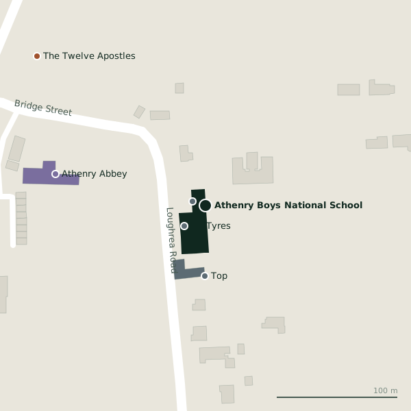
Plan of the surrounding 300 m
Getting to Athenry Boys National School
- By car
- Park at Athenry Town on North Gate Street, 359 m away, paid, 23 spaces. Athenry is 20 km from Galway city.
- By bus
- The nearest stop is The Arch Athenry, 395 m away.
- Directions from where you are
- Open the model above, tap the pin and choose “Directions here”; the route is drawn from your own position.
While you are there
7 places to eat and drink within 300 m: Luca's (245 m), The Square Inn (266 m), The Old Barracks (274 m) and Venue (283 m) and more.
3 shops within 300 m, including Athenry Country Market, Polska Chatka and Elegence Boutique.
Within a short walk
- Laffey's Garage11 mGarages
- DK Tyres24 mTyre centres
- Top58 mPetrol stations
- Athenry Abbey127 mHistoric churches
- The Twelve Apostles186 mMonuments
- Rooney Monumental Works188 mStonemason
- Athenry Post Office220 mPost office
- Beautinas224 mBeauty
Other schools in Athenry
- Vocational School Athenry369 mCaheroyan Road
- Presentation Primary374 mNorth Gate Street
- Presentation College Sports Field482 mCaheroyan Road
- 508 m
- 523 m
- 1.1 km
- Presentation College Athenry1.4 kmBallygarraun South
Questions people ask
Where is Athenry Boys National School?
Are there other schools nearby?
Source record: OpenStreetMap way/178062177, read on 2026-09-18. The street is the mapped address where there is one, otherwise the nearest named road. Distances are straight lines.