Laffey's Garage
Laffey's Garage is a garage on Loughrea Road in Athenry, County Galway, 276 m south-east of the Square. Athenry Boys National School, DK Tyres and Top are within 63 m.
- Kind
- Garages
- Street
- Loughrea Road
- From the Square
- 276 m south-east
- Parking
- Athenry Town on North Gate Street, 349 m away
- Bus stop
- The Arch Athenry, 386 m away
The map does not yet record a phone number, a website or opening hours for Laffey's Garage. Anyone can add them on OpenStreetMap; this page picks the change up at the next refresh.
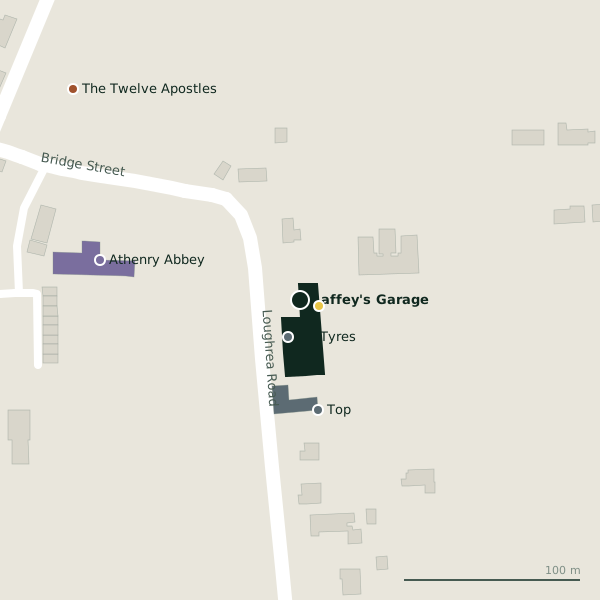
Plan of the surrounding 300 m
Getting to Laffey's Garage
- By car
- Park at Athenry Town on North Gate Street, 349 m away, paid, 23 spaces. Athenry is 20 km from Galway city.
- By bus
- The nearest stop is The Arch Athenry, 386 m away.
- Directions from where you are
- Open the model above, tap the pin and choose “Directions here”; the route is drawn from your own position.
While you are there
8 places to eat and drink within 300 m: Luca's (233 m), The Square Inn (254 m), The Old Barracks (263 m) and Venue (272 m) and more.
4 shops within 300 m, including Athenry Country Market, Polska Chatka and Elegence Boutique.
Loughrea Road itself has 3 named places on the map.
Within a short walk
- Athenry Boys National School11 mSchools
- DK Tyres22 mTyre centres
- Top63 mPetrol stations
- Athenry Abbey116 mHistoric churches
- The Twelve Apostles175 mMonuments
- Rooney Monumental Works180 mStonemason
- Athenry Post Office209 mPost office
- Beautinas213 mBeauty
Also on Loughrea Road
- DK TyresTyre centres
- South-East TowerTowers
Other garages in Athenry
- Kevin Burke Tyres915 mOakwood
Questions people ask
Where is Laffey's Garage?
Are there other garages nearby?
Source record: OpenStreetMap node/2046908569, read on 2026-09-18. The street is the mapped address where there is one, otherwise the nearest named road. Distances are straight lines.