South-West Tower
South-West Tower is a tower in the town in Athenry, County Galway, 513 m south-west of the Square. Athenry Pet Clinic, Ard Rí Bed & Breakfast and FDC Group are within 69 m.
- Kind
- Towers
- From the Square
- 513 m south-west
- Parking
- Backlawn Parking Lot, 226 m away
- Bus stop
- Athenry Shopping Centre, 383 m away
The map does not yet record a phone number, a website or opening hours for South-West Tower. Anyone can add them on OpenStreetMap; this page picks the change up at the next refresh.
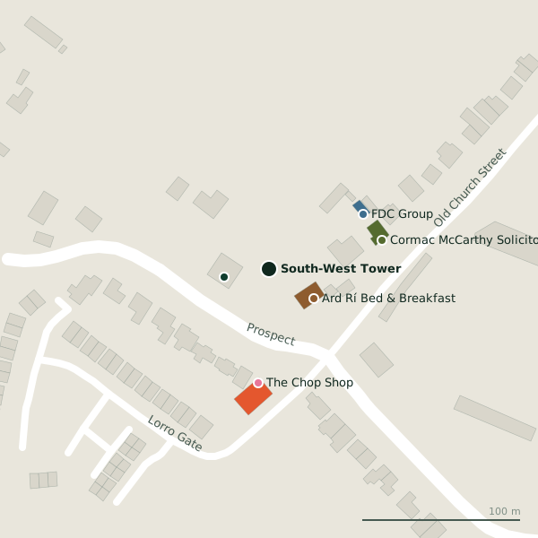
Plan of the surrounding 300 m
Getting to South-West Tower
- By car
- Park at Backlawn Parking Lot, 226 m away, paid, 133 spaces. Athenry is 20 km from Galway city.
- By bus
- The nearest stop is Athenry Shopping Centre, 383 m away.
- Directions from where you are
- Open the model above, tap the pin and choose “Directions here”; the route is drawn from your own position.
While you are there
2 places to eat and drink within 300 m: The Filling Station (78 m) and Hanberry’s Bar & Lounge (227 m).
2 shops within 300 m, including Daybreak and Aldi.
Other sites within 3 km: Heritage Center (582 m), The Twelve Apostles (625 m), Athenry Castle (703 m), Rathacugga (1.4 km) and Church (ruins) (2.7 km).
Within a short walk
- 29 m
- Ard Rí Bed & Breakfast34 mGuest houses
- FDC Group69 mInsurance
- The Chop Shop72 mHairdressers
- Cormac McCarthy Solicitors73 mSolicitors
- The Filling Station78 mCafés
- St Mary's Athenry - Kenny Park141 mSports centres
- Target Fitness222 mGyms
Other towers around Athenry
- 229 m
- 245 m
- 347 m
- 551 m
- South-East Tower628 mLoughrea Road
Questions people ask
Where is South-West Tower?
Are there other towers nearby?
Source record: OpenStreetMap way/1532498614, read on 2026-09-18. The street is the mapped address where there is one, otherwise the nearest named road. Distances are straight lines.