St Mary's Athenry - Kenny Park
St Mary's Athenry - Kenny Park is a sports centre on Old Church Street in Athenry, County Galway, 382 m south-west of the Square. Cormac McCarthy Solicitors, FDC Group and Target Fitness are within 82 m.
- Kind
- Sports centres
- Street
- Old Church Street
- From the Square
- 382 m south-west
- Website
- athenrygaa.ie
- Run by
- Athenry GAA
- Wheelchair
- Accessible
- Parking
- Backlawn Parking Lot, 86 m away
- Bus stop
- Athenry Shopping Centre, 344 m away
The map does not yet record a phone number or opening hours for St Mary's Athenry - Kenny Park. Anyone can add them on OpenStreetMap; this page picks the change up at the next refresh.
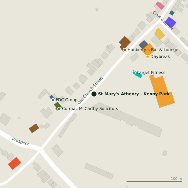
Getting to St Mary's Athenry - Kenny Park
- By car
- Park at Backlawn Parking Lot, 86 m away, paid, 133 spaces. Athenry is 20 km from Galway city.
- By bus
- The nearest stop is Athenry Shopping Centre, 344 m away.
- Directions from where you are
- Open the model above, tap the pin and choose “Directions here”; the route is drawn from your own position.
While you are there
4 places to eat and drink within 300 m: Hanberry’s Bar & Lounge (97 m), The Filling Station (183 m), The Fields Bar (221 m) and The Park Bar (233 m).
4 shops within 300 m, including Daybreak, Aldi and NCBI Charity Shop.
Old Church Street itself has 35 named places on the map, and 1 car park along it.
Within a short walk
- Cormac McCarthy Solicitors68 mSolicitors
- FDC Group75 mInsurance
- Target Fitness82 mGyms
- 97 m
- Daybreak118 mConvenience stores
- Top119 mPetrol stations
- Ard Rí Bed & Breakfast123 mGuest houses
- Aldi140 mSupermarkets
Also on Old Church Street
- AmicitaVisitor information
- Athenry AntiquesAntiques
- Athenry Family Dental PracticeDentists
- Athenry Fire StationFire station
- Athenry LibraryLibrary
- Cathal Moran AuctioneerEstate agents
- ChinatownRestaurants
- Church St. BarbersHairdressers
Everything on Old Church Street (35 places)
Other sports centres in Athenry
- 1.9 km
- 2.0 km
Questions people ask
Where is St Mary's Athenry - Kenny Park?
Are there other sports centres nearby?
Source record: OpenStreetMap way/178004424, read on 2026-09-18. The street is the mapped address where there is one, otherwise the nearest named road. Distances are straight lines.