Height of Health
Height of Health is a health food on Dunlo Street in Ballinasloe, County Galway, on the centre. P. Clarke, Life Pharmacy and Apache Pizza are within 24 m.
- Kind
- Health food
- Street
- Dunlo Street
- From the centre
- On the centre
- Parking
- Aldi Car Park, 533 m away
- Bus stop
- Stop, 128 m away
The map does not yet record a phone number, a website or opening hours for Height of Health. Anyone can add them on OpenStreetMap; this page picks the change up at the next refresh.
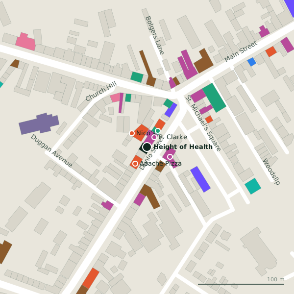
Plan of the surrounding 300 m
Getting to Height of Health
- By car
- Park at Aldi Car Park, 533 m away. Ballinasloe is 55 km from Galway city.
- By bus
- The nearest stop is an unnamed stop, 128 m away.
- Directions from where you are
- Open the model above, tap the pin and choose “Directions here”; the route is drawn from your own position.
While you are there
14 places to eat and drink within 300 m: Apache Pizza (24 m), Nico's (24 m), The Dunlo Tavern (30 m) and Good Taste (32 m) and more.
12 shops within 300 m, including P. Clarke, Kathleen's and Hubert Dolan.
Dunlo Street itself has 16 named places on the map.
Within a short walk
- P. Clarke14 mElectronics
- Life Pharmacy22 mPharmacies
- Apache Pizza24 mTakeaways
- Nico's24 mTakeaways
- Kathleen's29 mClothes shops
- The Dunlo Tavern30 mPubs
- Good Taste32 mTakeaways
- Paddy Power44 mBookmaker
Also on Dunlo Street
- AIBBanks
- Apache PizzaTakeaways
- Ballinasloe Garda StationGarda station
- Carry OutOff licences
- Good TasteTakeaways
- HaydensHotels
- Hubert DolanElectronics
- Kathleen'sClothes shops
Everything on Dunlo Street (16 places)
Questions people ask
Where is Height of Health?
Source record: OpenStreetMap node/9995596146, read on 2026-09-18. The street is the mapped address where there is one, otherwise the nearest named road. Distances are straight lines.