High Society
High Society is a hairdresser on Society Street in Ballinasloe, County Galway, 198 m west of the centre. Emerald Bar, Moran Court Vets and Ballinasloe Town Hall Theatre are within 68 m.
- Kind
- Hairdressers
- Street
- Unit 3 Society Street
- From the centre
- 198 m west
- Parking
- Aldi Car Park, 662 m away
- Bus stop
- Stop, 243 m away
The map does not yet record a phone number, a website or opening hours for High Society. Anyone can add them on OpenStreetMap; this page picks the change up at the next refresh.
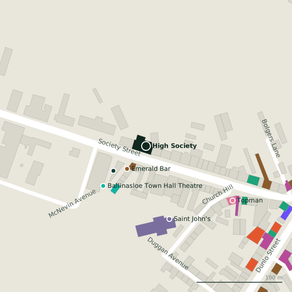
Plan of the surrounding 300 m
Getting to High Society
- By car
- Park at Aldi Car Park, 662 m away. Ballinasloe is 55 km from Galway city.
- By bus
- The nearest stop is an unnamed stop, 243 m away.
- Directions from where you are
- Open the model above, tap the pin and choose “Directions here”; the route is drawn from your own position.
While you are there
15 places to eat and drink within 300 m: Emerald Bar (35 m), Ryan's (143 m), Joe's Bar (151 m) and Nico's (158 m) and more.
11 shops within 300 m, including Expert, Fones 4 U and P. Clarke.
Society Street itself has 17 named places on the map.
Within a short walk
- Emerald Bar35 mPubs
- Moran Court Vets48 mVets
- 68 m
- Saint John's89 mChurches
- Topman119 mHairdressers
- Bar One Racing123 mBookmaker
- Expert123 mElectronics
- Brodericks131 mPharmacies
Also on Society Street
- Ballinasloe Fire StationFire station
- Bar One RacingBookmaker
- BrodericksPharmacies
- Claire Healy PharmacyPharmacies
- Emerald BarPubs
- ExpertElectronics
- Fones 4 UPhone shops
Everything on Society Street (17 places)
Other hairdressers in Ballinasloe
- Topman119 mSociety Street
Questions people ask
Where is High Society?
Are there other hairdressers nearby?
Source record: OpenStreetMap node/1546473838, read on 2026-09-18. The street is the mapped address where there is one, otherwise the nearest named road. Distances are straight lines.