Church Street
Church Street is the R446, a regional road in Creagh, 395 m east of the centre. It runs 824 m from Shannonbridge Road to Athlone Road, about 10 minutes on foot end to end. It has 2 named places on the map: butcher and takeaway.
- Type
- Regional road (R446)
- Length
- 824 m of mapped road
- From the centre
- 395 m east
- Runs
- from Shannonbridge Road to Athlone Road
- Density
- 2 named places over 824 m, 0.2 per 100 m
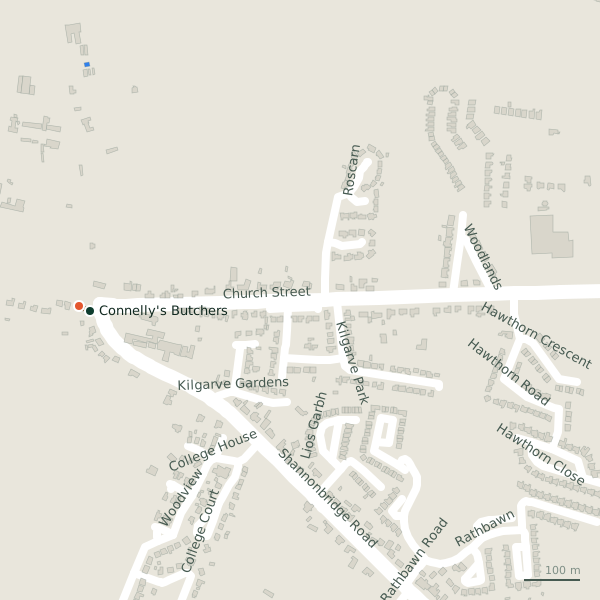
The street is drawn in black; buildings are coloured by what is in them. Drag to turn the model, tap a pin for the place.
Plan of the street
A walk along Church Street
Start at the Shannonbridge Road end and walk towards Athlone Road: a butcher and a takeaway share the 824 m. 1 of the 2 places on the street has opening hours on record, and it opens on Sundays.
What is on Church Street
1 butchers and 1 takeaways, each with its own page.
Restaurants · 1
- Creagh Pizza House+353 90 963 1468Takeaways
Other places · 1
- Connelly's ButchersButchers
Streets it joins
- Athlone Roadregional road
- Hawthorn Roadresidential street
- Kilgarve Parkresidential street
- Roscarnresidential street
- Shannonbridge Roadlink road · 3 places
- Woodlandsresidential street
Questions people ask
Where is Church Street?
How long is Church Street?
What is on Church Street?
Browse by kind
Geometry, names and places from OpenStreetMap, read on 2026-09-18. Length is the sum of the mapped segments carrying this name; distances are straight lines from the street's midpoint.