Áras an Chontae
Áras an Chontae is a council office on Prospect Hill in Galway, County Galway, 212 m north of Eyre Square. Corrib Shopping Centre, Galway County Council and Apoema Bistro are within 53 m.
- Kind
- Council offices
- Street
- Prospect Hill
- From Eyre Square
- 212 m north
- Run by
- Galway County Council
- Wheelchair
- Accessible
- Parking
- Corrib Centre Car Park, 111 m away
- Bus stop
- St Bridget's Place (Bus Éireann), 139 m away
The map does not yet record a phone number, a website or opening hours for Áras an Chontae. Anyone can add them on OpenStreetMap; this page picks the change up at the next refresh.
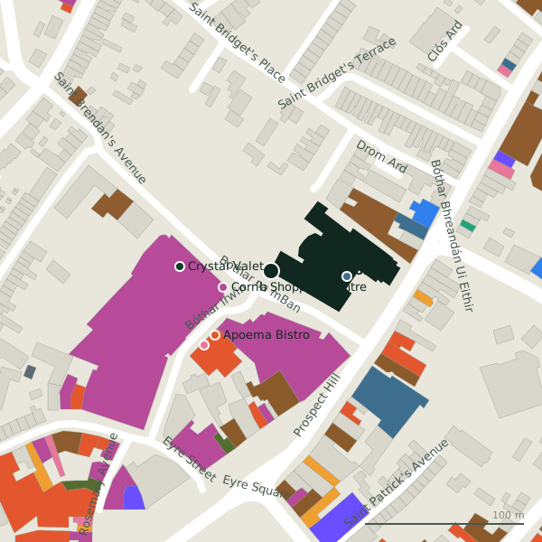
Plan of the surrounding 300 m
Getting to Áras an Chontae
- By car
- Park at Corrib Centre Car Park, 111 m away, paid.
- By bus
- The nearest stop is St Bridget's Place, served by Bus Éireann, 139 m away.
- Directions from where you are
- Open the model above, tap the pin and choose “Directions here”; the route is drawn from your own position.
While you are there
67 places to eat and drink within 300 m: Apoema Bistro (53 m), Screene's on the Square (85 m), Osaka (88 m) and The Ol’ 55 (88 m) and more.
49 shops within 300 m, including Corrib Shopping Centre, M&S Foodhall and TK Maxx.
Prospect Hill itself has 30 named places on the map.
Within a short walk
- Corrib Shopping Centre32 mShopping centres
- Galway County Council47 mGovernment offices
- Apoema Bistro53 mRestaurants
- Crystal Valet58 mCar wash
- Barber Station62 mHairdressers
- M&S Foodhall63 mSupermarkets
- TK Maxx71 mDepartment stores
- Marks & Spencer76 mDepartment stores
Also on Prospect Hill
- Armazém BrazilConvenience stores
- Bar One RacingBookmaker
- BeautyphileBeauty
- Bohermore Post OfficePost office
- BoyleSportsBookmaker
- County HallBike hire
- Domino'sTakeaways
- Elephant and CastleRestaurants
Everything on Prospect Hill (30 places)
Other council offices in Galway
- Galway City Hall343 mCollege Road
Questions people ask
Where is Áras an Chontae?
Are there other council offices nearby?
Source record: OpenStreetMap way/52408251, read on 2026-09-18. The street is the mapped address where there is one, otherwise the nearest named road. Distances are straight lines.