Bridge Stores
Bridge Stores is a convenience store on Bridge Street in Galway, County Galway, 518 m south-west of Eyre Square. It trades under the Your Stop name. Galway Dental Clinic, Kennedy Fitzgerald Solicitors and Cuddy Dental are within 11 m.
- Street
- Bridge Street
- From Eyre Square
- 518 m south-west
- Parking
- Spanish Arch Car Park on Kirwan's Lane, 113 m away
- Bus stop
- Spanish Arch (Bus Éireann), 163 m away
The map does not yet record a phone number, a website or opening hours for Bridge Stores. Anyone can add them on OpenStreetMap; this page picks the change up at the next refresh.
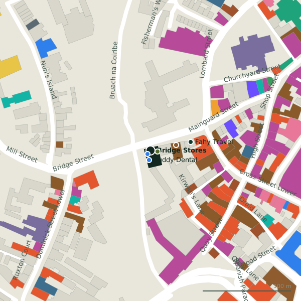
Plan of the surrounding 300 m
Getting to Bridge Stores
- By car
- Park at Spanish Arch Car Park on Kirwan's Lane, 113 m away, paid.
- By bus
- The nearest stop is Spanish Arch, served by Bus Éireann, 163 m away, with a shelter.
- Directions from where you are
- Open the model above, tap the pin and choose “Directions here”; the route is drawn from your own position.
While you are there
122 places to eat and drink within 300 m: Seven (29 m), Nut Hot (53 m), Supermac's (61 m) and Kirby's (68 m) and more.
81 shops within 300 m, including Speed Queen, Cavavin and Tempo Antiques.
Bridge Street itself has 9 named places on the map.
Within a short walk
- Galway Dental Clinic5 mDentists
- Kennedy Fitzgerald Solicitors8 mSolicitors
- Cuddy Dental11 mDentists
- Seven29 mPubs
- Fahy Travel47 mTravel agency
- Nut Hot53 mTakeaways
- Supermac's61 mTakeaways
- 64 m
Also on Bridge Street
- Cuddy DentalDentists
- Fahy TravelTravel agency
- Galway Dental ClinicDentists
- IL VicoloRestaurants
- Kennedy Fitzgerald SolicitorsSolicitors
- Nut HotTakeaways
- SevenPubs
Other convenience stores in Galway
- Spar86 mMainguard Street
- XL103 mDominick Street Lower
- Local Express216 mSaint Augustine Street
- Centra237 mRaven Terrace
- McCambridges249 mShop Street
- No. 26293 mDominick Street Upper
- Candy Cloud295 mAbbeygate Street Lower
- Asiatic Manila296 mAbbeygate Street Upper
Questions people ask
Where is Bridge Stores?
Are there other convenience stores nearby?
Source record: OpenStreetMap node/925970967, read on 2026-09-18. The street is the mapped address where there is one, otherwise the nearest named road. Distances are straight lines.