Butlers Chocolate Café
Butlers Chocolate Café is a café on William Street in Galway, County Galway, 214 m south-west of Eyre Square. The Joke Shop, ór and Lovisa are within 6 m.
- Kind
- Cafés
- Street
- 40 William Street
- From Eyre Square
- 214 m south-west
- Wheelchair
- Accessible
- Parking
- Eyre Square Centre Car Park on Whitehall, 120 m away
- Bus stop
- Stop, 170 m away
The map does not yet record a phone number, a website or opening hours for Butlers Chocolate Café. Anyone can add them on OpenStreetMap; this page picks the change up at the next refresh.
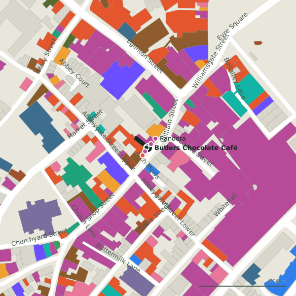
Plan of the surrounding 300 m
Getting to Butlers Chocolate Café
- By car
- Park at Eyre Square Centre Car Park on Whitehall, 120 m away, paid, 450 spaces.
- By bus
- The nearest stop is an unnamed stop, 170 m away, with a shelter.
- Directions from where you are
- Open the model above, tap the pin and choose “Directions here”; the route is drawn from your own position.
While you are there
135 places to eat and drink within 300 m: Fixx (11 m), Garavan’s (18 m), Tuco’s Taqueria (43 m) and The Lighthouse Cafe (47 m) and more.
152 shops within 300 m, including ór, Lovisa and Pandora.
William Street itself has 20 named places on the map.
Within a short walk
- The Joke Shop2 mParty
- ór5 mJewellers
- Lovisa6 mJewellers
- Fixx11 mCafés
- Pandora14 mJewellers
- Crew17 mHairdressers
- Garavan’s18 mPubs
- Tribes Sweater Shop18 mClothes shops
Also on William Street
- A. Hartmann & SonJewellers
- CrewHairdressers
- EirPhone shops
- FieldsJewellers
- FixxCafés
- Galway Camera ShopCamera
- Garavan’sPubs
- Gino'sIce cream
Everything on William Street (20 places)
Other cafés in Galway
- Fixx11 mWilliam Street
- The Lighthouse Cafe47 mAbbeygate Street Upper
- Fairhill Coffee Design Studio61 mAbbeygate Street Upper
- Gourmet Tart Co.63 mAbbeygate Street Lower
- Java's91 mAbbeygate Street Upper
- Little Collins CBD Dispensary109 mAbbeygate Street Upper
- Caprice117 mChurch Lane
- CoCo ToGo119 mWilliamsgate Street
Questions people ask
Where is Butlers Chocolate Café?
Are there other cafés nearby?
Source record: OpenStreetMap node/699771693, read on 2026-09-18. The street is the mapped address where there is one, otherwise the nearest named road. Distances are straight lines.