CeX
CeX is an electronic on Headford Road in Galway, County Galway, 720 m north of Eyre Square. Lana Alterations, Sky TV Kiosk and R. Dent are within 28 m.
- Kind
- Electronics
- Street
- Headford Road
- From Eyre Square
- 720 m north
- Wheelchair
- Accessible
- Parking
- Dyke Road Car Park on Dyke Road, 440 m away
- Bus stop
- Galway Centre (Bus Éireann), 150 m away
The map does not yet record a phone number, a website or opening hours for CeX. Anyone can add them on OpenStreetMap; this page picks the change up at the next refresh.
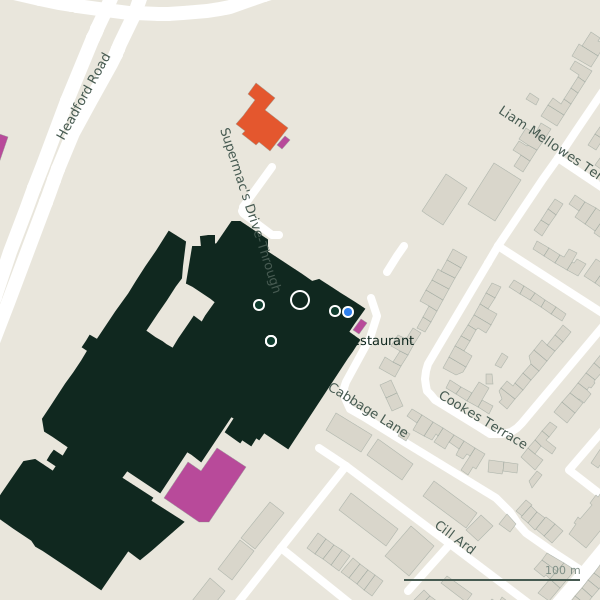
Plan of the surrounding 300 m
Getting to CeX
- By car
- Park at Dyke Road Car Park on Dyke Road, 440 m away, paid.
- By bus
- The nearest stop is Galway Centre, served by Bus Éireann, 150 m away, with a shelter.
- Directions from where you are
- Open the model above, tap the pin and choose “Directions here”; the route is drawn from your own position.
While you are there
9 places to eat and drink within 300 m: Franklins Restaurant (29 m), Supermac's (33 m), Insomnia (74 m) and Álainn (88 m) and more.
27 shops within 300 m, including Carraig Donn, Born Clothing and Eir.
Headford Road itself has 97 named places on the map, and 1 car park along it.
Within a short walk
- Lana Alterations21 mTailor
- Sky TV Kiosk23 mKiosk
- R. Dent28 mDentists
- Franklins Restaurant29 mRestaurants
- IT Star29 mElectronics repair
- Hale30 mE-cigarette
- Carraig Donn31 mClothes shops
- Supermac's33 mTakeaways
Also on Headford Road
- 3 StorePhone shops
- ÁlainnCafés
- AldiSupermarkets
- An Mheitheal RotharBike shops
- Ballindooly CastleCastles
- BellissimoHairdressers
- BestDriveGarages
- BodkinBike hire
Everything on Headford Road (97 places)
Other electronics in Galway
- Expert108 mHeadford Road
- Currys203 mHeadford Road
- Kellihers Electrical279 mSean Mulvoy Road
- O'Connors Audio Visual367 mSean Mulvoy Road
- DID Electrical496 mHeadford Road
- HUGMIE806 mWilliamsgate Street
- Cunniffe Electrical1.7 kmTuam Road
- Expert2.1 kmSeamus Quirke Road
Questions people ask
Where is CeX?
Are there other electronics nearby?
Source record: OpenStreetMap way/954710167, read on 2026-09-18. The street is the mapped address where there is one, otherwise the nearest named road. Distances are straight lines.