Galway Bay FM
Galway Bay FM is a studio on Sandyroad in Galway, County Galway, 1.3 km north-east of Eyre Square. Nox Hotel, Sheils Motorpark and Corribe Tackle are within 148 m.
- Kind
- Studio
- Street
- Sandyroad
- From Eyre Square
- 1.3 km north-east
- Read more
- Galway Bay FM on Wikipedia
- Bus stop
- Stop, 293 m away
The map does not yet record a phone number, a website or opening hours for Galway Bay FM. Anyone can add them on OpenStreetMap; this page picks the change up at the next refresh.
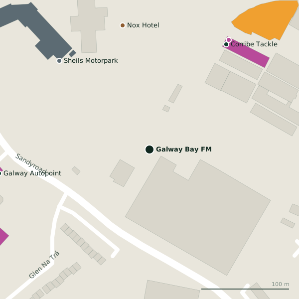
Getting to Galway Bay FM
- By bus
- The nearest stop is an unnamed stop, 293 m away, with a shelter.
- Directions from where you are
- Open the model above, tap the pin and choose “Directions here”; the route is drawn from your own position.
While you are there
3 places to eat and drink within 300 m: Olive Tree Bistro (255 m), Point Bar (272 m) and Apache Pizza (286 m).
21 shops within 300 m, including Seahourse Aquariums, Petworld and EZ Living Furniture.
Sandyroad itself has 4 named places on the map.
Within a short walk
- Nox Hotel144 mHotels
- Sheils Motorpark144 mCar dealers
- Corribe Tackle148 mFishing
- Seahourse Aquariums154 mPet shops
- Galway Autopoint173 mCar wash
- William's Gate173 mButchers
- Europcar181 mCar hire
- Petworld188 mPet shops
Also on Sandyroad
- HondaCar dealers
- Olive Tree BistroRestaurants
- Point BarBars
Other studio in Galway
- Flirt FM 101.31.4 kmUniversity Road
- 1.8 km
- Sundtrack & Podcast2.0 kmDominick Street Lower
- Galway Rehersal Studios2.1 kmBallybane Industrial Estate
- Corrib Dance Academy3.5 kmBriarhill Business Park
Questions people ask
Where is Galway Bay FM?
Are there other studio nearby?
Source record: OpenStreetMap way/161440517, read on 2026-09-18. The street is the mapped address where there is one, otherwise the nearest named road. Distances are straight lines.