Parks · Barna Road · Galway
Hunters Park
Hunters Park is a park on Barna Road in Galway, County Galway, 5.6 km west of Eyre Square. The South Wood and Galway & Claddagh Swan Rescue are within 142 m.
- Kind
- Parks
- Street
- Barna Road
- From Eyre Square
- 5.6 km west
- Run by
- Galway City Council
- Bus stop
- Cappagh Road - Woodfield (City Direct), 656 m away
The map does not yet record a phone number, a website or opening hours for Hunters Park. Anyone can add them on OpenStreetMap; this page picks the change up at the next refresh.
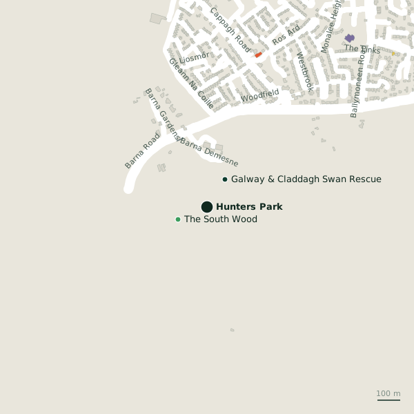
Getting to Hunters Park
- By bus
- The nearest stop is Cappagh Road - Woodfield, served by City Direct, 656 m away.
- Directions from where you are
- Open the model above, tap the pin and choose “Directions here”; the route is drawn from your own position.
While you are there
Barna Road itself has 5 named places on the map.
Other sites within 3 km: The South Wood (137 m), Tobar Éanna (258 m), Coillte Loch Roisín (269 m), The North Wood (371 m) and Bird Sanctuary (379 m).
Within a short walk
- The South Wood137 mWoods
- Galway & Claddagh Swan Rescue142 mAnimal shelter
Also on Barna Road
- Rusheen Bay Windsurfing SchoolSports centres
- Silverstrand Service StationConvenience stores
- TexacoPetrol stations
- The North WoodWoods
Other parks around Galway
- Cappagh Park960 mCappagh Park
- McGraths Field Park1.3 kmSeacrest
- Circle of Life2.8 kmSalthill Promenade
- Quincentennial Park2.8 kmSalthill Promenade
- 3.2 km
- Salthill Park3.2 kmPark Avenue
- Devon Park3.6 kmDevon Gardens
- Westside Park3.7 kmCircular Road
Questions people ask
Where is Hunters Park?
On Barna Road in Galway, 5.6 km west of Eyre Square.
Are there other parks nearby?
27 other parks around $Galway; the closest is Cappagh Park, 960 m away.
Source record: OpenStreetMap way/116709648, read on 2026-09-18. The street is the mapped address where there is one, otherwise the nearest named road. Distances are straight lines.