Lambe Institute for Translational Research
Lambe Institute for Translational Research is a research in the town in Galway, County Galway, 1.1 km west of Eyre Square. HRB Clinical Research Facility, University Hospital Galway and The Sliding Rock are within 170 m.
- Kind
- Research
- From Eyre Square
- 1.1 km west
- Run by
- University of Galway
- Parking
- Car Park 4, 128 m away
- Bus stop
- McDara Road (Bus Éireann), 108 m away
The map does not yet record a phone number, a website or opening hours for Lambe Institute for Translational Research. Anyone can add them on OpenStreetMap; this page picks the change up at the next refresh.
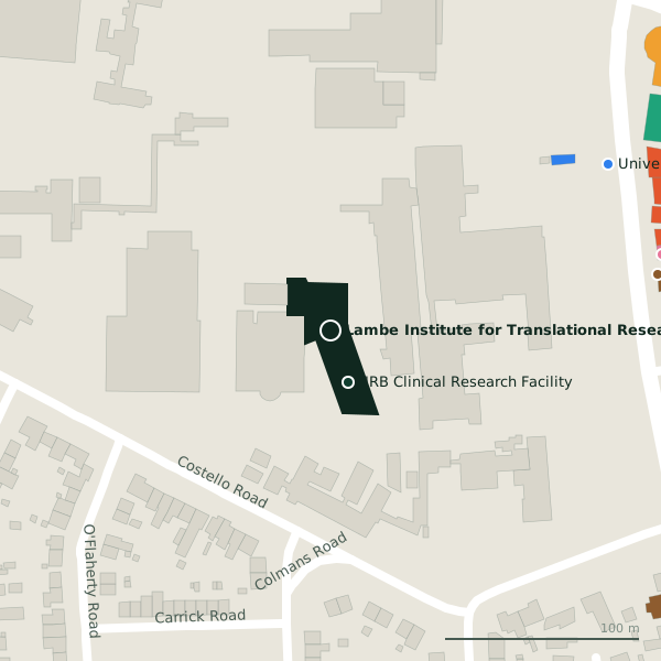
Plan of the surrounding 300 m
Getting to Lambe Institute for Translational Research
- By car
- Park at Car Park 4, 128 m away, paid, 35 spaces.
- By bus
- The nearest stop is McDara Road, served by Bus Éireann, 108 m away.
- Directions from where you are
- Open the model above, tap the pin and choose “Directions here”; the route is drawn from your own position.
While you are there
11 places to eat and drink within 300 m: The Sliding Rock (171 m), Abrakebabra (175 m), Gourmet Tart Co. (176 m) and Zambrero (176 m) and more.
2 shops within 300 m, including Londis and Tesco Express.
Within a short walk
- HRB Clinical Research Facility28 mResearch
- University Hospital Galway166 mHospital
- The Sliding Rock170 mPubs
- Abrakebabra175 mTakeaways
- Newcastle Barbers175 mHairdressers
- Paddy Power175 mBookmaker
- Gourmet Tart Co.176 mCafés
- Zambrero176 mTakeaways
Other research in Galway
- 28 m
- ICHEC (National Supercomputing Centre)723 mNUI Galway
Questions people ask
Where is Lambe Institute for Translational Research?
Are there other research nearby?
Source record: OpenStreetMap node/10077504056, read on 2026-09-18. The street is the mapped address where there is one, otherwise the nearest named road. Distances are straight lines.