Matt O'Flaherty
Matt O'Flaherty is a pharmacy on Millennium Promenade in Galway, County Galway, 1.0 km north-west of Eyre Square. Student's Union Shop, Hardiman Research Building and Oasis are within 50 m.
- Kind
- Pharmacies
- Street
- Millennium Promenade
- From Eyre Square
- 1.0 km north-west
- Wheelchair
- Accessible
- Parking
- Car Park 2 on Newcastle Avenue, 316 m away
- Bus stop
- Newcastle PO (Bus Éireann;City Direct), 138 m away
The map does not yet record a phone number, a website or opening hours for Matt O'Flaherty. Anyone can add them on OpenStreetMap; this page picks the change up at the next refresh.
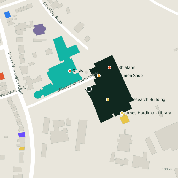
Plan of the surrounding 300 m
Getting to Matt O'Flaherty
- By car
- Park at Car Park 2 on Newcastle Avenue, 316 m away, paid.
- By bus
- The nearest stop is Newcastle PO, served by Bus Éireann;City Direct, 138 m away.
- Directions from where you are
- Open the model above, tap the pin and choose “Directions here”; the route is drawn from your own position.
While you are there
10 places to eat and drink within 300 m: Oasis (50 m), An Bhialann (57 m), Smokey's (93 m) and Mocha Beans (166 m) and more.
2 shops within 300 m, including Student's Union Shop and Cope Galway - Corrib Day Centre.
Millennium Promenade itself has 4 named places on the map.
Within a short walk
- Student's Union Shop31 mConvenience stores
- Hardiman Research Building41 mLibrary
- Oasis50 mCafés
- An Bhialann57 mRestaurants
- James Hardiman Library78 mLibrary
- Nursing Library80 mLibrary
- Smokey's93 mCafés
- Siobhan McKenna Theatre100 mTheatre
Also on Millennium Promenade
- An BhialannRestaurants
- OasisCafés
- Siobhan McKenna TheatreTheatre
Other pharmacies in Galway
- University Late Night Pharmacy354 mNewcastle Road
- GoWest Pharmacy755 mOld Seamus Quirke Road
- Cleary's Pharmacy768 mMary Street
- Moughans793 mNewcastle Road
- Matt O'Flaherty919 mWilliam Street
- Matt O'Flaherty Chemists924 mHeadford Road
- Whelan's Care Plus929 mWilliamsgate Street
- Boots945 mShop Street
Questions people ask
Where is Matt O'Flaherty?
Are there other pharmacies nearby?
Source record: OpenStreetMap node/3405453336, read on 2026-09-18. The street is the mapped address where there is one, otherwise the nearest named road. Distances are straight lines.