McGraths Field Playground
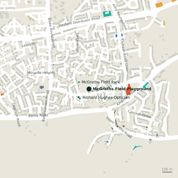
McGraths Field Playground is a playground in the town in Galway, County Galway, 4.3 km west of Eyre Square. McGraths Field Park, Richard Hughes Optician and Seacrest Kafe are within 130 m.
- Kind
- Playgrounds
- From Eyre Square
- 4.3 km west
- Run by
- Galway City Council
- Bus stop
- Shangort Road - Knocknacarra Park (City Direct), 48 m away
The map does not yet record a phone number, a website or opening hours for McGraths Field Playground. Anyone can add them on OpenStreetMap; this page picks the change up at the next refresh.
Getting to McGraths Field Playground
- By bus
- The nearest stop is Shangort Road - Knocknacarra Park, served by City Direct, 48 m away.
- Directions from where you are
- Open the model above, tap the pin and choose “Directions here”; the route is drawn from your own position.
While you are there
1 place to eat or drink within 300 m: Seacrest Kafe (130 m).
Other sites within 3 km: McGraths Field Park (124 m), Tobermaconry (site of) (755 m), Bird Sanctuary (949 m), Coillte Loch Roisín (1.0 km) and Cappagh Park (1.2 km).
Within a short walk
- McGraths Field Park124 mParks
- Richard Hughes Optician126 mOpticians
- Seacrest Kafe130 mCafés
- BoyleSports134 mBookmaker
- Molloys135 mPharmacies
- Little Rascals217 mChildcare
Other playgrounds around Galway
- 1.3 km
- Claude Toft Park Playground2.6 kmSeapoint Promenade
- Mary Byrne Playground3.5 kmHenry Street
- Claddagh Playground3.9 kmNimmo's Pier
- Kennedy Park Playground4.3 kmEyre Square
- 8.5 km
- Treasure Island Kids Zone8.8 kmMerlin Commercial Park
Questions people ask
Where is McGraths Field Playground?
Are there other playgrounds nearby?
Source record: OpenStreetMap way/203503581, read on 2026-09-18. The street is the mapped address where there is one, otherwise the nearest named road. Distances are straight lines.