Noel Maher Hair Co.
Noel Maher Hair Co. is a hairdresser in the town in Galway, County Galway, 4.5 km north-east of Eyre Square. O'Hehirs Bakery & Cafe, Cara Diamonds and Xpress News are within 7 m.
- Kind
- Hairdressers
- From Eyre Square
- 4.5 km north-east
- Wheelchair
- Accessible
- Bus stop
- Stop (Bus Éireann), 87 m away
The map does not yet record a phone number, a website or opening hours for Noel Maher Hair Co.. Anyone can add them on OpenStreetMap; this page picks the change up at the next refresh.
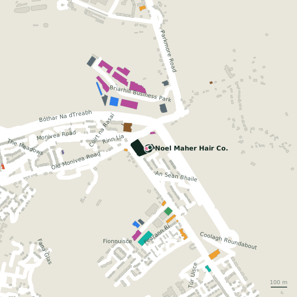
Plan of the surrounding 300 m
Getting to Noel Maher Hair Co.
- By bus
- The nearest stop is an unnamed stop, served by Bus Éireann, 87 m away, with a shelter.
- Directions from where you are
- Open the model above, tap the pin and choose “Directions here”; the route is drawn from your own position.
While you are there
4 places to eat and drink within 300 m: Grind Coffee and Food Hub (28 m), Cafe Sol (66 m), KFC (98 m) and Enclosure Bar & Bistro (174 m).
8 shops within 300 m, including Cara Diamonds, Xpress News and Dunnes Stores.
Within a short walk
- O'Hehirs Bakery & Cafe6 mBakeries
- Cara Diamonds7 mJewellers
- Xpress News7 mConvenience stores
- The Beauty Emporium12 mBeauty
- The Health Store12 mHealth food
- Briarhill Butchers13 mButchers
- Optique Opticians17 mOpticians
- Briarhill Pharmacy18 mPharmacies
Other hairdressers in Galway
- 40 m
- Fringe Benefits548 mFearann Rí
- Headmaster Barbers556 mFearann Rí
- Sapien884 mDalton House
- Hair Care1.7 kmBallybane Road
- Stylistic Hair & Beauty1.7 kmRoscam House
- Salon Services1.9 kmGlenrock Business Park
- The Hair and Beauty Company1.9 kmBallybane Industrial Estate
Questions people ask
Where is Noel Maher Hair Co.?
Are there other hairdressers nearby?
Source record: OpenStreetMap node/2103642008, read on 2026-09-18. The street is the mapped address where there is one, otherwise the nearest named road. Distances are straight lines.