Opus II
Opus II is a music shop on High Street in Galway, County Galway, 436 m south-west of Eyre Square. Silverwood Jewellery, Sonny Molloy’s and Grogans are within 8 m.
- Kind
- Music shops
- Street
- High Street
- From Eyre Square
- 436 m south-west
- Website
- opus2galway.ie
- Wheelchair
- Accessible
- Parking
- Spanish Arch Car Park on Kirwan's Lane, 102 m away
- Bus stop
- Jury's Hotel (Bus Éireann), 128 m away
The map does not yet record a phone number or opening hours for Opus II. Anyone can add them on OpenStreetMap; this page picks the change up at the next refresh.
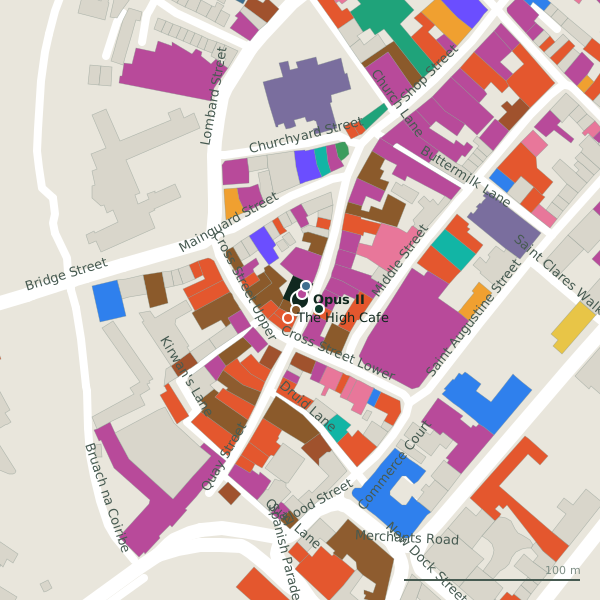
Plan of the surrounding 300 m
Getting to Opus II
- By car
- Park at Spanish Arch Car Park on Kirwan's Lane, 102 m away, paid.
- By bus
- The nearest stop is Jury's Hotel, served by Bus Éireann, 128 m away.
- Directions from where you are
- Open the model above, tap the pin and choose “Directions here”; the route is drawn from your own position.
While you are there
113 places to eat and drink within 300 m: Sonny Molloy’s (6 m), The High Cafe (12 m), Nana's Tea (13 m) and The Bunch of Grapes (13 m) and more.
103 shops within 300 m, including Silverwood Jewellery, Galway Gifts and Kilkenny.
High Street itself has 32 named places on the map, and 1 car park along it.
Within a short walk
- Silverwood Jewellery4 mJewellers
- Sonny Molloy’s6 mPubs
- Grogans8 mAccountants
- Kenny Joes12 mConfectionery
- The High Cafe12 mRestaurants
- Nana's Tea13 mCafés
- 13 m
- Galway Gifts14 mGift shops
Also on High Street
- ÁlainnCafés
- Alddin's CaveGift shops
- Aran Islands KnitwearClothes shops
- Auntie NelliesConfectionery
- Carrolls Irish GiftsGift shops
- Cloon KeenPerfumery
- Elements of GalwayGift shops
- Faller's Sweater ShopClothes shops
Everything on High Street (32 places)
Other music shops in Galway
- Moloney Musical Instruments46 mHigh Street
- Powell's204 mWilliam Street
- Golden Discs426 mEyre Square
Questions people ask
Where is Opus II?
Are there other music shops nearby?
Source record: OpenStreetMap node/1469613268, read on 2026-09-18. The street is the mapped address where there is one, otherwise the nearest named road. Distances are straight lines.