Our Lady's College Galway
Our Lady's College Galway is a school on Presentation Road in Galway, County Galway, 750 m west of Eyre Square. Saint Joseph's, Presentation Convent and Scoil Chroí Íosa are within 118 m.
- Kind
- Schools
- Street
- Presentation Road
- From Eyre Square
- 750 m west
- Parking
- Free Parking on Gaol Road, 211 m away
- Bus stop
- Stop, 52 m away
The map does not yet record a phone number, a website or opening hours for Our Lady's College Galway. Anyone can add them on OpenStreetMap; this page picks the change up at the next refresh.
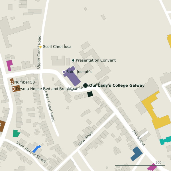
Plan of the surrounding 300 m
Getting to Our Lady's College Galway
- By car
- Park at Free Parking on Gaol Road, 211 m away.
- By bus
- The nearest stop is an unnamed stop, 52 m away.
- Directions from where you are
- Open the model above, tap the pin and choose “Directions here”; the route is drawn from your own position.
While you are there
3 places to eat and drink within 300 m: Cooke’s Thatch Bar (189 m), Hooked (205 m) and Galway Arms Inn (296 m).
3 shops within 300 m, including The Gourmet Offensive, Ali's Fish Market and Don't Call Me Dear Boutique.
Presentation Road itself has 3 named places on the map.
Within a short walk
- Saint Joseph's51 mChurches
- Presentation Convent55 mMonastery
- Scoil Chroí Íosa118 mSchools
- Desota House Bed and Breakfast143 mGuest houses
- Number 53147 mGuest houses
- 154 m
- 156 m
- George Conboy Electrical158 mElectrical
Also on Presentation Road
- Number 53Guest houses
- Saint Joseph'sChurches
Other schools in Galway
- Scoil Chroí Íosa118 mNewcastle Road
- Saint Joseph's Patrician College156 mNun's Island
- Coláiste Muire Máthair282 mSaint Mary's Road
- Coláiste Iognáid344 mSea Road
- Scoil Iognáid359 mRaleigh Row
- Saint Patricks Primary School390 mBridge Street
- Galway Educate Together Secondary School453 mNewtownsmith
- Scoil an Linbh Íosa494 mSaint Francis Street
Questions people ask
Where is Our Lady's College Galway?
Are there other schools nearby?
Source record: OpenStreetMap way/162473310, read on 2026-09-18. The street is the mapped address where there is one, otherwise the nearest named road. Distances are straight lines.