Pagoda's Temple
Pagoda's Temple is a dojo on Oldenway Business Park in Galway, County Galway, 3.4 km north-east of Eyre Square. Let It Rain, Ballybrit Social Inclusion Coop and GCSJ - Playschool & Activity Centre are within 6 m.
- Kind
- Dojo
- Street
- Oldenway Business Park
- From Eyre Square
- 3.4 km north-east
- Parking
- Clareview Park on Clareview Park, 812 m away
- Bus stop
- Castlepark Road (Bus Éireann), 192 m away
The map does not yet record a phone number, a website or opening hours for Pagoda's Temple. Anyone can add them on OpenStreetMap; this page picks the change up at the next refresh.
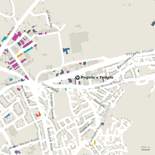
Plan of the surrounding 300 m
Getting to Pagoda's Temple
- By car
- Park at Clareview Park on Clareview Park, 812 m away, free.
- By bus
- The nearest stop is Castlepark Road, served by Bus Éireann, 192 m away.
- Directions from where you are
- Open the model above, tap the pin and choose “Directions here”; the route is drawn from your own position.
While you are there
2 places to eat and drink within 300 m: Cruinniú (171 m) and Ed's Place (176 m).
3 shops within 300 m, including Sammon's Home Furnishings, Centra and McGreals Mace.
Oldenway Business Park itself has 24 named places on the map.
Within a short walk
- Let It Rain2 mRoofer
- Ballybrit Social Inclusion Coop4 mSocial services
- GCSJ - Playschool & Activity Centre6 mChildcare
- 8 m
- Irish Training Academy16 mCompanies
- Redeemed Christian Church of God17 mChurches
- Windsor Car & Van Rental21 mCar hire
- Designwise Interiors & Associates25 mInterior decoration
Also on Oldenway Business Park
- A1 SignsSignmaker
- Ballybrit Exhaust & Tyre CentreTyre centres
- Ballybrit Social Inclusion CoopSocial services
- Complex MotorsCompanies
- Designwise Interiors & AssociatesInterior decoration
- Feeney-Keating LimitedMetal construction
- Galway Bay CoffeeCompanies
Everything on Oldenway Business Park (24 places)
Other dojo in Galway
- Galway City School of Judo8 mOldenway Business Park
- Shaolin MMA2.2 kmTuam Road
Questions people ask
Where is Pagoda's Temple?
Are there other dojo nearby?
Source record: OpenStreetMap node/2103642011, read on 2026-09-18. The street is the mapped address where there is one, otherwise the nearest named road. Distances are straight lines.