Bike hire · Corrib Village · Galway
Park & Ride NUIG
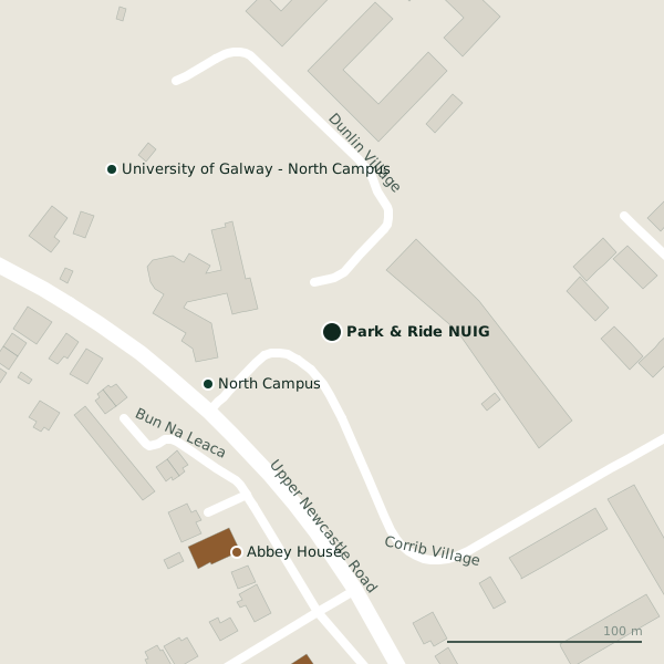
Park & Ride NUIG is a bike hire on Corrib Village in Galway, County Galway, 2.1 km north-west of Eyre Square. It trades under the TFI Bikes name. North Campus, Abbey House and University of Galway - North Campus are within 140 m.
- Kind
- Bike hire
- Street
- Corrib Village
- From Eyre Square
- 2.1 km north-west
- Website
- bikeshare.ie
- Run by
- An Rothar Nua
- Parking
- Dangan Carpark, 347 m away
- Bus stop
- Stop (National University of Ireland Galway), 60 m away
The map does not yet record a phone number or opening hours for Park & Ride NUIG. Anyone can add them on OpenStreetMap; this page picks the change up at the next refresh.
Getting to Park & Ride NUIG
- By car
- Park at Dangan Carpark, 347 m away, free.
- By bus
- The nearest stop is an unnamed stop, served by National University of Ireland Galway, 60 m away, with a shelter.
- Directions from where you are
- Open the model above, tap the pin and choose “Directions here”; the route is drawn from your own position.
While you are there
1 shop within 300 m, including Day-Today.
Corrib Village itself has 3 named places on the map.
Within a short walk
- North Campus69 mVisitor information
- Abbey House123 mGuest houses
- University of Galway - North Campus140 mUniversities
- Corrib Haven174 mGuest houses
- Day-Today219 mConvenience stores
Also on Corrib Village
- Day-TodayConvenience stores
- North CampusVisitor information
Other bike hire in Galway
- 847 m
- ROBUST E-Mobility Hub: E-Bikes, E-Cargo Bike1.3 kmSeamus Quirke Road
- Sacred Heart (Seamus Quirke Rd)1.4 kmSeamus Quirke Road
- O'Shaughnessy Bridge1.5 kmFisheries Field
- Bodkin1.6 kmHeadford Road
- Cathedral1.6 kmUniversity Road
- Headford Road1.7 kmHeadford Road
- Gaol Road1.8 kmGaol Road
Questions people ask
Where is Park & Ride NUIG?
On Corrib Village in Galway, 2.1 km north-west of Eyre Square; the nearest car park is 347 m away.
Are there other bike hire nearby?
21 other bike hire in $Galway; the closest is Kingfisher, NUIG, 847 m away.
Source record: OpenStreetMap node/8977965849, read on 2026-09-18. The street is the mapped address where there is one, otherwise the nearest named road. Distances are straight lines.