Secure All Security Group
Secure All Security Group is a security in the town in Galway, County Galway, 4.5 km north-east of Eyre Square. Optima Strength, Cutting Edge Tiles and Surreal Designs are within 12 m.
- Kind
- Security
- From Eyre Square
- 4.5 km north-east
- Bus stop
- Monivea Road (Bus Éireann), 163 m away
The map does not yet record a phone number, a website or opening hours for Secure All Security Group. Anyone can add them on OpenStreetMap; this page picks the change up at the next refresh.
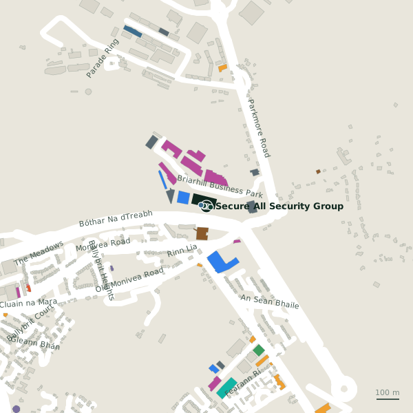
Plan of the surrounding 300 m
Getting to Secure All Security Group
- By bus
- The nearest stop is Monivea Road, served by Bus Éireann, 163 m away, with a shelter.
- Directions from where you are
- Open the model above, tap the pin and choose “Directions here”; the route is drawn from your own position.
While you are there
6 places to eat and drink within 300 m: Roots (108 m), Enclosure Bar & Bistro (128 m), Grindhouse Cafe (170 m) and KFC (204 m) and more.
17 shops within 300 m, including J&D Furniture, Petworld and DID Electrical.
Within a short walk
- Optima Strength2 mCompanies
- Cutting Edge Tiles8 mFlooring
- Surreal Designs12 mInterior decoration
- Cash And Carry Kitchens18 mKitchen
- Link Financial25 mFinancial services
- Tubs and Tiles30 mBathroom furnishing
- J&D Furniture31 mFurniture
- Petworld35 mPet shops
Other security in Galway
- Chubb Ireland Limited713 mRacecourse Business Park
- Gemini Security Systems6.1 kmWestside Business Centre
Questions people ask
Where is Secure All Security Group?
Are there other security nearby?
Source record: OpenStreetMap node/11151338178, read on 2026-09-18. The street is the mapped address where there is one, otherwise the nearest named road. Distances are straight lines.