The Sheep
The Sheep is a wool on Mainguard Street in Galway, County Galway, 408 m south-west of Eyre Square. Fatface, Deelys Cafe and Le Petit Délice are within 13 m.
- Kind
- Wool
- Street
- 4 Mainguard Street
- From Eyre Square
- 408 m south-west
- Wheelchair
- Accessible
- Parking
- Spanish Arch Car Park on Kirwan's Lane, 144 m away
- Bus stop
- Jury's Hotel (Bus Éireann), 176 m away
The map does not yet record a phone number or a website for The Sheep. Anyone can add them on OpenStreetMap; this page picks the change up at the next refresh.
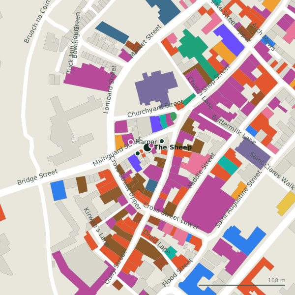
Plan of the surrounding 300 m
Getting to The Sheep
- By car
- Park at Spanish Arch Car Park on Kirwan's Lane, 144 m away, paid.
- By bus
- The nearest stop is Jury's Hotel, served by Bus Éireann, 176 m away.
- Directions from where you are
- Open the model above, tap the pin and choose “Directions here”; the route is drawn from your own position.
While you are there
123 places to eat and drink within 300 m: Deelys Cafe (9 m), Álainn (22 m), Murphy’s (25 m) and Tig Coilí (34 m) and more.
129 shops within 300 m, including Fatface, Harper and Spar.
Mainguard Street itself has 14 named places on the map.
Opening hours
As recorded on the map: Mo-Sa 10:00-18:00; Su,PH 12:00-17:00
As recorded on OpenStreetMap on 2026-09-18; bank holidays may differ.
Within a short walk
- Fatface5 mClothes shops
- Deelys Cafe9 mCafés
- Le Petit Délice13 mPastry
- Evergreen Healthfood18 mHealth food
- Harper20 mClothes shops
- 21 m
- Álainn22 mCafés
- Murphy's Ice Cream22 mIce cream
Also on Mainguard Street
- Bank of IrelandBanks
- Bridie Murphy's Home BakeryBakeries
- Claddagh JewellersJewellers
- Deelys CafeCafés
- Evergreen HealthfoodHealth food
- FatfaceClothes shops
- HarperClothes shops
- Le Petit DélicePastry
Everything on Mainguard Street (14 places)
Questions people ask
Where is The Sheep?
When is The Sheep open?
Source record: OpenStreetMap node/1861571882, read on 2026-09-18. The street is the mapped address where there is one, otherwise the nearest named road. Distances are straight lines.