Upick Store
Upick Store is a deli on Westside Business Centre in Galway, County Galway, 1.8 km west of Eyre Square. Quiff Hair Studio, In Kitchens and Style Kloset Boutique are within 12 m.
- Kind
- Delis
- From Eyre Square
- 1.8 km west
- Phone
- +353 91 581826
- Wheelchair
- Accessible
- Parking
- Car Park 3, 568 m away
- Bus stop
- Westside Centre (Bus Éireann;City Direct), 44 m away
The map does not yet record a website or opening hours for Upick Store. Anyone can add them on OpenStreetMap; this page picks the change up at the next refresh.
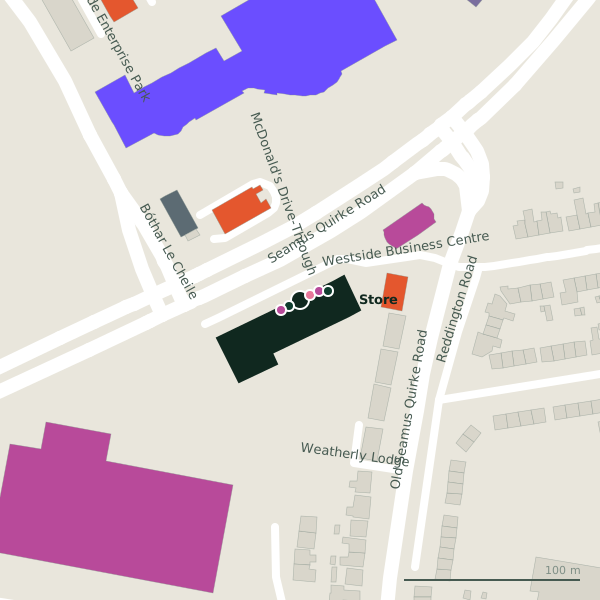
Plan of the surrounding 300 m
Getting to Upick Store
- By car
- Park at Car Park 3, 568 m away, paid.
- By bus
- The nearest stop is Westside Centre, served by Bus Éireann;City Direct, 44 m away, with a shelter.
- Directions from where you are
- Open the model above, tap the pin and choose “Directions here”; the route is drawn from your own position.
While you are there
6 places to eat and drink within 300 m: The Captain's Cabin (55 m), Domino's (58 m), McDonald's (66 m) and Insomnia (122 m) and more.
15 shops within 300 m, including Style Kloset Boutique, Westside Cycles and Fine Wines.
Westside Business Centre itself has 12 named places on the map.
Within a short walk
- Quiff Hair Studio6 mHairdressers
- In Kitchens7 mKitchen
- Style Kloset Boutique12 mClothes shops
- Westside Cycles12 mBike shops
- Gemini Security Systems17 mSecurity
- Acme Blinds18 mWindow blind
- Cutting Edge Tiles20 mTiles
- 25 m
Also on Westside Business Centre
- A&D CarpetsCarpet
- Acme BlindsWindow blind
- Dai HireTool hire
- Fine WinesOff licences
- Gemini Security SystemsSecurity
- In KitchensKitchen
- McCorbett GlazingGlaziery
Everything on Westside Business Centre (12 places)
Other delis in Galway
- The Gourmet Offensive902 mNewcastle Road
- European Food Store2.3 kmTerryland Retail Park
- Terryland Asian Food Market2.3 kmTerryland Retail Park
- 2.4 km
- Blackrock Cottage Pantry2.6 kmUpper Salthill Road
Questions people ask
Where is Upick Store?
How do I contact Upick Store?
Are there other delis nearby?
Source record: OpenStreetMap node/2107075591, read on 2026-09-18. The street is the mapped address where there is one, otherwise the nearest named road. Distances are straight lines.