Gyms · Galway
Yoga Darsana
Yoga Darsana is a gym in the town in Galway, County Galway, 1.8 km south-west of Eyre Square. Dominican College, Taylor's Hill Primary School and The Continental Boutique Residence are within 241 m.
- Kind
- Gyms
- From Eyre Square
- 1.8 km south-west
- Parking
- Claude Toft Car Park on Seapoint Promenade, 821 m away
- Bus stop
- St Anne's (Bus Éireann), 182 m away
The map does not yet record a phone number, a website or opening hours for Yoga Darsana. Anyone can add them on OpenStreetMap; this page picks the change up at the next refresh.
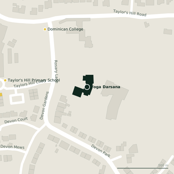
The building in black is this one; drag to turn the model.Open the whole town
Plan of the surrounding 300 m
Getting to Yoga Darsana
- By car
- Park at Claude Toft Car Park on Seapoint Promenade, 821 m away, free, 139 spaces.
- By bus
- The nearest stop is St Anne's, served by Bus Éireann, 182 m away.
- Directions from where you are
- Open the model above, tap the pin and choose “Directions here”; the route is drawn from your own position.
While you are there
1 place to eat or drink within 300 m: P.J. Flaherty (253 m).
1 shop within 300 m, including Knocknacarra Florist.
Within a short walk
- Dominican College139 mSchools
- Taylor's Hill Primary School160 mSchools
- 241 m
Other gyms in Galway
- Ardiluan Hotel Leisure Club392 mTaylor's Hill Road
- MTF Gym898 mDr Mannix Road
- énergie Fitness925 mUpper Salthill Road
- An Seomra Yoga978 mSmall Crane
- Train Station Galway1.0 kmMunster Avenue
- The Sportsdome1.2 kmThreadneedle Road
- DFC Gym Galway1.2 kmThreadneedle Road
- Ocean Fitness1.3 kmSalthill Promenade
Questions people ask
Where is Yoga Darsana?
In Galway, County Galway, 1.8 km south-west of Eyre Square; the nearest car park is 821 m away.
Are there other gyms nearby?
44 other gyms in $Galway; the closest is Ardiluan Hotel Leisure Club, 392 m away.
Source record: OpenStreetMap node/12231487963, read on 2026-09-18. The street is the mapped address where there is one, otherwise the nearest named road. Distances are straight lines.