residential street · $Galway, County Galway
Áltan
Áltan is a residential street in Galway, 3.5 km west of Eyre Square. It is 182 m long, about 2 minutes on foot end to end. It has 1 named place on the map: childcare.
- Type
- Residential street
- Length
- 182 m of mapped road
- From Eyre Square
- 3.5 km west
- Joins
- Áltan Road
- Runs
- from Áltan Road
- Nearest bus stop
- Stop, 270 m away
- Nearest parking
- National Aquarium Car Park on Seapoint Promenade, 2.0 km away
- Density
- 1 named place over 182 m, 0.5 per 100 m
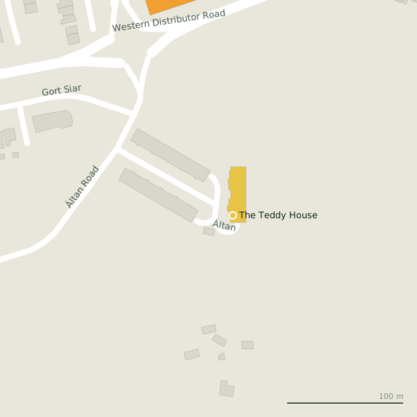
The street is drawn in black; buildings are coloured by what is in them. Drag to turn the model, tap a pin for the place.
Plan of the street
A walk along Áltan
Walking its length a childcare share the 182 m.
What is on Áltan
1 childcare, each with its own page.
Schools · 1
- The Teddy House+353 91 573 090Childcare
Streets it joins
- Áltan Roadminor road
Questions people ask
Where is Áltan?
In Galway, County Galway, 3.5 km west of Eyre Square, joining Áltan Road.
How long is Áltan?
182 m, measured along the mapped centre line; about 2 minutes on foot end to end.
What is on Áltan?
1 named place: The Teddy House.
Is there a bus stop on Áltan?
Not on the street itself; the nearest on the map is an unnamed stop on Western Distributor Road, 270 m from the middle of the street.
Where can I park near Áltan?
The nearest car park is National Aquarium Car Park on Seapoint Promenade, 2.0 km away.
Browse by kind
Geometry, names and places from OpenStreetMap, read on 2026-09-18. Length is the sum of the mapped segments carrying this name; distances are straight lines from the street's midpoint.