link road · L5004 · $Galway, County Galway
Cappagh Road
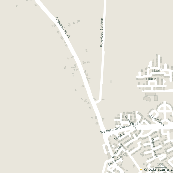
Cappagh Road is the L5004, a link road in Galway, 5.5 km west of Eyre Square. It runs 2.9 km from Barna Road to An Bhuaile Bheag, about 36 minutes on foot end to end. It has 2 named places on the map: community centre and school.
- Type
- Link road (L5004)
- Length
- 2.9 km of mapped road
- From Eyre Square
- 5.5 km west
- Joins
- An Bhuaile Bheag, An Cimín Mór, Barna Road, Boleybeg Bóithrín, Cappagh Park, Coill Mhara, Cúirt Roisín, Dún Alainn, Gillsfort Court, Léana Mór, Léana Theas, Léana Thuaidh, Liosmór, Radharc Na gCorr, Ros Ard, Silín, Silver Seas, Slí na Coille, Woodfield
- Runs
- from Barna Road to An Bhuaile Bheag
- Bus stops
- Cappagh Road - Cimín Mór; Cappagh Road - Woodfield; Cappagh Park; Cappagh Park; Mount Prospect; Cappagh Road - Liosmore
- Nearest parking
- National Aquarium Car Park on Seapoint Promenade, 4.1 km away
- Density
- 2 named places over 2.9 km, 0.1 per 100 m
The street is drawn in black; buildings are coloured by what is in them. Drag to turn the model, tap a pin for the place.
Plan of the street
A walk along Cappagh Road
Start at the Barna Road end and walk towards An Bhuaile Bheag: a community centre and a school share the 2.9 km. Buses stop on the street itself at 6 stops.
What is on Cappagh Road
1 community centres and 1 schools, each with its own page.
Schools · 1
- +353 91 590 627
Other places · 1
- Knocknacarra Community CentreCommunity centres
Streets it joins
- An Bhuaile Bheaglink road
- An Cimín Mórresidential street
- Barna Roadresidential street · 5 places
- Boleybeg Bóithrínminor road
- Cappagh Parkservice road · 1 place
- Coill Mhararesidential street
- Cúirt Roisínresidential street
- Dún Alainnresidential street
- Gillsfort Courtresidential street
- Léana Mórresidential street
- Léana Theasresidential street
- Léana Thuaidhroad
- Liosmórresidential street
- Radharc Na gCorrresidential street
- Ros Ardresidential street · 5 places
- Silínresidential street
- Silver Seasresidential street
- Slí na Coilleresidential street
- Woodfieldresidential street
Questions people ask
Where is Cappagh Road?
In Galway, County Galway, 5.5 km west of Eyre Square, joining An Bhuaile Bheag, An Cimín Mór and Barna Road.
How long is Cappagh Road?
2.9 km, measured along the mapped centre line; about 36 minutes on foot end to end.
What is on Cappagh Road?
2 named places: Knocknacarra Community Centre and Knocknacarra Educate Together National School.
Is there a bus stop on Cappagh Road?
Yes: Cappagh Road - Cimín Mór, Cappagh Road - Woodfield, Cappagh Park, Cappagh Park, Mount Prospect and Cappagh Road - Liosmore.
Where can I park near Cappagh Road?
The nearest car park is National Aquarium Car Park on Seapoint Promenade, 4.1 km away.
Geometry, names and places from OpenStreetMap, read on 2026-09-18. Length is the sum of the mapped segments carrying this name; distances are straight lines from the street's midpoint.