An Bóthar Mór
An Bóthar Mór is a minor road in Kilronan, 436 m north-west of the pier. It runs 1.9 km from Main Road, about 24 minutes on foot end to end. It has 15 named places on the map: 3 bike hire, 2 clothes shops, café and bank and more.
- Type
- Minor road
- Length
- 1.9 km of mapped road
- From the pier
- 436 m north-west
- Joins
- The Low Road
- Runs
- from Main Road
- Density
- 15 named places over 1.9 km, 0.8 per 100 m
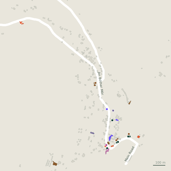
The street is drawn in black; buildings are coloured by what is in them. Drag to turn the model, tap a pin for the place.
Plan of the street
A walk along An Bóthar Mór
Walking its length 3 bike hire, 2 clothes shops, a café, a bank, a historic church and a rental and more share the 1.9 km.
What is on An Bóthar Mór
3 bike hire, 2 clothes shops, 1 cafés, 1 banks and 1 historic churches and more, each with its own page.
Restaurants · 2
- Aran Islands CaféCafés
- Mainistir House+353 99 61169Restaurants
Pubs · 1
- Tí Joe Watty’s+353 86 0494509Pubs
Shops · 2
- Aran Islands KnitwearClothes shops
- Aran Sweater Market+353 64 6639756Clothes shops
Banks · 1
- Bank of IrelandBanks
Hotels · 2
- Kilronan Hostel+353 99 61255Hostels
- Pier ViewGuest houses
Churches · 1
- Church of St ThomasHistoric churches
Other places · 6
- Burke's Bicycle Hire+353 87 2808273Bike hire
- Inis Mór Bicycle HireRental
- Kilronan Bike HireBike hire
- Kilronan Fire StationFire station
- Rainbow Bike HireBike hire
- Tourist Information CentreVisitor information
Streets it joins
- The Low Roadminor road · 2 places
Questions people ask
Where is An Bóthar Mór?
How long is An Bóthar Mór?
What is on An Bóthar Mór?
Geometry, names and places from OpenStreetMap, read on 2026-09-18. Length is the sum of the mapped segments carrying this name; distances are straight lines from the street's midpoint.