The Framer
The Framer is a frame on Main Street in Kinvarra, County Galway, on the quay. Tully’s, Brian MacMahon and The Thatch Bar are within 33 m.
- Kind
- Frame
- Street
- Main Street
- From the quay
- On the quay
- Parking
- Castle Parking on Dunguaire Cottages, 793 m away
- Bus stop
- Main Street Opp Eurospar (Bus Éireann), 88 m away
The map does not yet record a phone number, a website or opening hours for The Framer. Anyone can add them on OpenStreetMap; this page picks the change up at the next refresh.
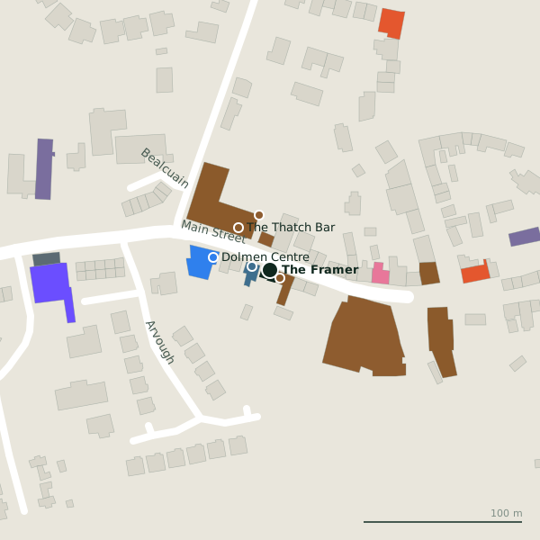
Plan of the surrounding 300 m
Getting to The Framer
- By car
- Park at Castle Parking on Dunguaire Cottages, 793 m away, free. Kinvarra is 17 km from Galway city.
- By bus
- The nearest stop is Main Street Opp Eurospar, served by Bus Éireann, 88 m away.
- Directions from where you are
- Open the model above, tap the pin and choose “Directions here”; the route is drawn from your own position.
While you are there
12 places to eat and drink within 300 m: Tully’s (8 m), The Thatch Bar (33 m), Conoles (103 m) and Keogh’s (105 m) and more.
2 shops within 300 m, including Eurospar and Costcutter.
Main Street itself has 22 named places on the map.
Within a short walk
- Tully’s8 mPubs
- Brian MacMahon12 mEstate agents
- The Thatch Bar33 mPubs
- Merriman Hotel35 mHotels
- Dolmen Centre37 mSocial services
- Fallons B&B51 mGuest houses
- Eurospar65 mSupermarkets
- Kinvara Beauty Salon73 mBeauty
Also on Main Street
- Brian MacMahonEstate agents
- Circle KPetrol stations
- ConolesPubs
- Corless Funeral HomeFuneral directors
- CostcutterConvenience stores
- DBdentalDentists
- Dolmen CentreSocial services
- EurosparSupermarkets
Everything on Main Street (22 places)
Questions people ask
Where is The Framer?
Source record: OpenStreetMap node/10717472919, read on 2026-09-18. The street is the mapped address where there is one, otherwise the nearest named road. Distances are straight lines.