Schools · Loughrea
Saint Raphael's College
Saint Raphael's College is a school in the town in Loughrea, County Galway, 417 m east of the centre. Riverview Montessori, St Brigids Vocational School and Top Lock are within 234 m.
- Kind
- Schools
- From the centre
- 417 m east
- Phone
- +353 91 841 062
- Website
- saintraphaels.ie
- Parking
- O'Dea's Hotel Car Park on The Crescent, 324 m away
- Bus stop
- Loughrea (Bus Éireann), 307 m away
The map does not yet record opening hours for Saint Raphael's College. Anyone can add them on OpenStreetMap; this page picks the change up at the next refresh.
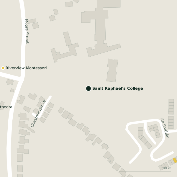
Getting to Saint Raphael's College
- By car
- Park at O'Dea's Hotel Car Park on The Crescent, 324 m away, paid. Loughrea is 33 km from Galway city.
- By bus
- The nearest stop is Loughrea, served by Bus Éireann, 307 m away.
- Directions from where you are
- Open the model above, tap the pin and choose “Directions here”; the route is drawn from your own position.
While you are there
3 places to eat and drink within 300 m: Maggie Mays (264 m), Java’s17 Cafe & Creperie (291 m) and Il Porcetto (298 m).
3 shops within 300 m, including O'Reilly's Newsagents, Cunnane and iPhone Master.
Within a short walk
- Riverview Montessori169 mChildcare
- St Brigids Vocational School233 mSchools
- Top Lock234 mLocksmith
- Donohues Garage235 mGarages
- St. Brendan's Cathedral238 mChurches
Other schools in Loughrea
- St Brigids Vocational School233 mAn Sruthán
- Saint Brendans Boys National School324 mMount Pleasant
- Gaelscoil Riabhach1.7 kmCarraig Ard
- Gaelscoil Riabhach1.8 kmCosmona
Questions people ask
Where is Saint Raphael's College?
In Loughrea, County Galway, 417 m east of the centre; the nearest car park is 324 m away.
How do I contact Saint Raphael's College?
By phone on +353 91 841 062, or through saintraphaels.ie.
Are there other schools nearby?
4 other schools in $Loughrea; the closest is St Brigids Vocational School, 233 m away.
Source record: OpenStreetMap way/840266551, read on 2026-09-18. The street is the mapped address where there is one, otherwise the nearest named road. Distances are straight lines.