The Auld Triangle
The Auld Triangle is a pub on Barrack Street in Loughrea, County Galway, on the centre. Lakeshore Medical Centre, Loughrea Garda Station and Loughrea Fire Station are within 74 m.
- Kind
- Pubs
- Street
- Barrack Street
- From the centre
- On the centre
- Parking
- Short Term Car Park, 211 m away
- Bus stop
- Loughrea (Bus Éireann), 120 m away
The map does not yet record a phone number, a website or opening hours for The Auld Triangle. Anyone can add them on OpenStreetMap; this page picks the change up at the next refresh.
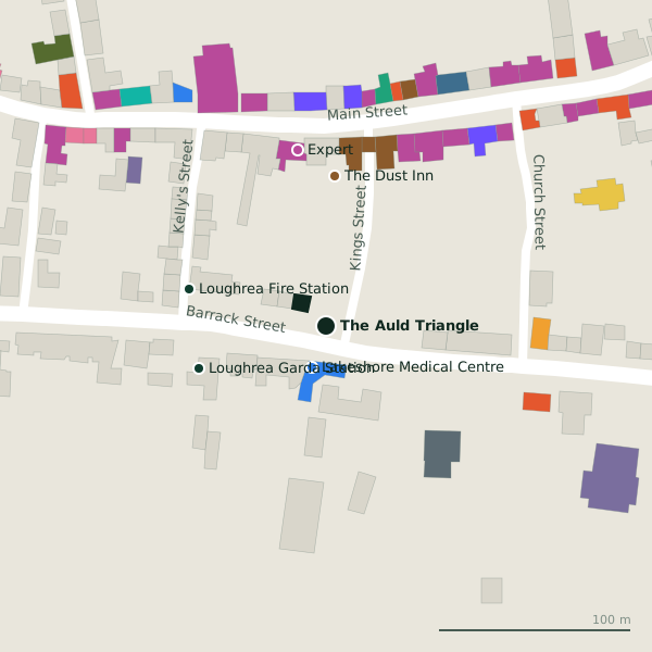
Plan of the surrounding 300 m
Getting to The Auld Triangle
- By car
- Park at Short Term Car Park, 211 m away, paid, 117 spaces. Loughrea is 33 km from Galway city.
- By bus
- The nearest stop is Loughrea, served by Bus Éireann, 120 m away.
- Directions from where you are
- Open the model above, tap the pin and choose “Directions here”; the route is drawn from your own position.
While you are there
15 places to eat and drink within 300 m: The Dust Inn (78 m), Kinsella’s (101 m), Mike Keary’s (106 m) and Java’s17 Cafe & Creperie (111 m) and more.
23 shops within 300 m, including Expert, Centra and O'Reilly's Newsagents.
Barrack Street itself has 7 named places on the map.
Within a short walk
- Lakeshore Medical Centre23 mClinics
- Loughrea Garda Station70 mGarda station
- Loughrea Fire Station74 mFire station
- The Dust Inn78 mPubs
- Expert93 mElectronics
- Kinsella’s101 mPubs
- Lakeside Motors102 mGarages
- Centra104 mSupermarkets
Also on Barrack Street
- Lakeshore Medical CentreClinics
- Loughrea Fire StationFire station
- Loughrea Garda StationGarda station
- Riverview MontessoriChildcare
- St. Brendan's CathedralChurches
- Top LockLocksmith
Other pubs in Loughrea
- The Dust Inn78 mKings Street
- Kinsella’s101 mMain Street
- Mike Keary’s106 mMain Street
- Moylan’s123 mMain Street
- John Patrick’s130 mMain Street
- Charlie’s Bar143 mMain Street
- Madden’s153 mMain Street
- Dawdy Kenny’s;Dawdy Kenny's157 mMain Street
Questions people ask
Where is The Auld Triangle?
Are there other pubs nearby?
Source record: OpenStreetMap node/2053316781, read on 2026-09-18. The street is the mapped address where there is one, otherwise the nearest named road. Distances are straight lines.