The Western Way B&B
The Western Way B&B is a guest house on Camp Street in Oughterard, County Galway, 288 m north-east of the centre. Fough East B&B, Abhainn Ruibhe B&B and McGeough's Butchers are within 119 m.
- Kind
- Guest houses
- Street
- Camp Street
- From the centre
- 288 m north-east
- Bus stop
- Stop, 305 m away
The map does not yet record a phone number, a website or opening hours for The Western Way B&B. Anyone can add them on OpenStreetMap; this page picks the change up at the next refresh.
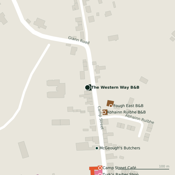
Plan of the surrounding 300 m
Getting to The Western Way B&B
- By bus
- The nearest stop is an unnamed stop, 305 m away.
- Directions from where you are
- Open the model above, tap the pin and choose “Directions here”; the route is drawn from your own position.
While you are there
11 places to eat and drink within 300 m: Camp Street Café (158 m), Kelly’s (177 m), Faherty’s (187 m) and Highlander Pizzeria (212 m) and more.
6 shops within 300 m, including Oughterard Building Supplies, Standún and Centra.
Camp Street itself has 8 named places on the map.
Within a short walk
- Fough East B&B57 mGuest houses
- Abhainn Ruibhe B&B58 mGuest houses
- McGeough's Butchers119 mButchers
- Camp Street Café158 mCafés
- Turk's Barber Shop171 mHairdressers
- Kelly’s176 mPubs
- Faherty’s186 mPubs
- Connemara Lake Hotel202 mHotels
Also on Camp Street
- Camp Street CaféCafés
- Faherty’sPubs
- Kelly’sPubs
- McGeough's ButchersButchers
- Roger Finnerty & SonsButchers
- StandúnDepartment stores
- Turk's Barber ShopHairdressers
Other guest houses in Oughterard
- Abhainn Ruibhe B&B58 mAbhainn Ruibhe
- Fough East B&B58 mAbhainn Ruibhe
- 329 m
- 1.2 km
Questions people ask
Where is The Western Way B&B?
Are there other guest houses nearby?
Source record: OpenStreetMap node/4371078142, read on 2026-09-18. The street is the mapped address where there is one, otherwise the nearest named road. Distances are straight lines.