Main Street
Main Street is the N59, a national road in Oughterard, 401 m east of the centre. It is 1.1 km long, about 14 minutes on foot end to end. It has 22 named places on the map: 4 pubs, 2 convenience stores, 2 restaurants and hairdresser and more.
- Type
- National road (N59)
- Length
- 1.1 km of mapped road
- From the centre
- 401 m east
- Runs
- from Bridge Street
- Bus stops
- Unnamed stop; Unnamed stop
- Nearest parking
- New Village Forest Recreation Area on Western Way High Road, 2.0 km away
- Density
- 22 named places over 1.1 km, 2 per 100 m
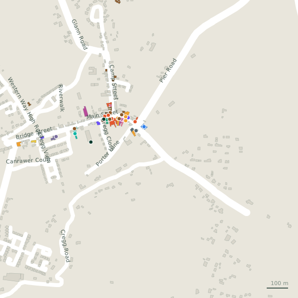
The street is drawn in black; buildings are coloured by what is in them. Drag to turn the model, tap a pin for the place.
Plan of the street
A walk along Main Street
Walking its length 4 pubs, 2 convenience stores, 2 restaurants, a hairdresser, a hotel and a gym and more share the 1.1 km. Buses stop on the street itself at 2 stops.
What is on Main Street
4 pubs, 2 convenience stores, 2 restaurants, 1 hairdressers and 1 hotels and more, each with its own page.
Restaurants · 4
- Greenway CaféCafés
- Halloran'sRestaurants
- Highlander PizzeriaRestaurants
- Supermac'sTakeaways
Pubs · 4
- Keogh’sPubs
- Power’s Thatch+35391557597Pubs
- The Angler’s BarPubs
- The Mayfly InnPubs
Shops · 1
- John P. Keogh's gifts and craftsGift shops
Hairdressers and beauty · 1
- Bridie's Unisex SalonHairdressers
Supermarkets · 3
- CentraConvenience stores
- Sullivan's Country GrocerConvenience stores
- TescoSupermarkets
Pharmacies · 1
- Flaherty's PharmacyPharmacies
Doctors · 1
Banks · 1
- Oughterard Post OfficePost office
Petrol · 1
- TopPetrol stations
Gyms and sport · 1
- Corrib GymGyms
Hotels · 1
- Connemara Lake Hotel+35391866016Hotels
Churches · 1
- Kilcummin Parish ChurchChurches
Other places · 2
- My Little Flower CoffeeCoffee
- Oughterard Community CentreCommunity centres
Streets it joins
- Bridge Streetnational road · 4 places
- Camp Streetlink road · 8 places
- Cregg Roadminor road
- Gregg Closeresidential street · 2 places
- Kilcummin Fieldresidential street
- Pier Roadlink road
- Porter Laneminor road · 2 places
Questions people ask
Where is Main Street?
How long is Main Street?
What is on Main Street?
Is there a bus stop on Main Street?
Where can I park near Main Street?
Browse by kind
- Pubs in Oughterard
- Convenience stores in Oughterard
- Restaurants in Oughterard
- Hairdressers in Oughterard
- Hotels in Oughterard
- Gyms in Oughterard
- Pharmacies in Oughterard
- Cafés in Oughterard
- Gift shops in Oughterard
- Churches in Oughterard
- Coffee in Oughterard
- Community centres in Oughterard
- Post office in Oughterard
- Clinics in Oughterard
- Takeaways in Oughterard
- Supermarkets in Oughterard
- Petrol stations in Oughterard
- All 23 streets
Geometry, names and places from OpenStreetMap, read on 2026-09-18. Length is the sum of the mapped segments carrying this name; distances are straight lines from the street's midpoint.