Tuam Road
Tuam Road is the N83, a national road in Claregalway, 562 m north of the bridge. It is 3.5 km long, about 44 minutes on foot end to end. It has 11 named places on the map: 2 restaurants, 2 supermarkets, hairdresser and dentist and more.
- Type
- National road (N83)
- Length
- 3.5 km of mapped road
- From the bridge
- 562 m north
- Bus stops
- Claregalway; Claregalway
- Density
- 11 named places over 3.5 km, 0.3 per 100 m
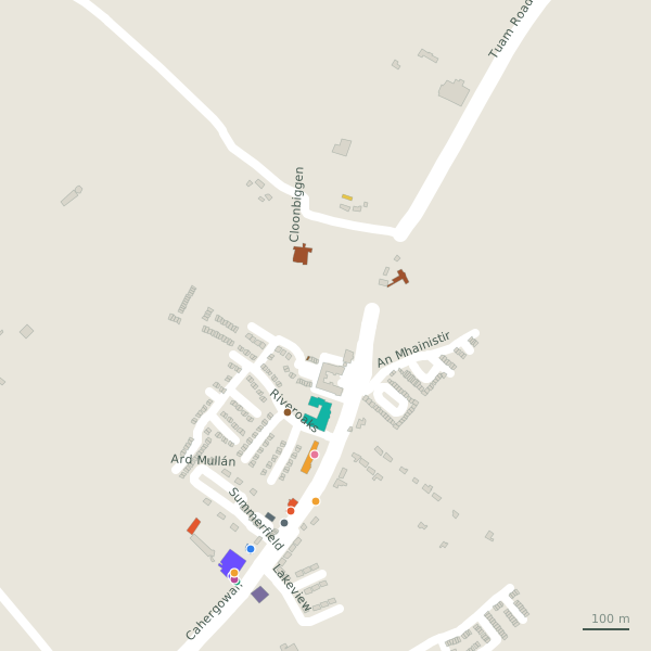
The street is drawn in black; buildings are coloured by what is in them. Drag to turn the model, tap a pin for the place.
Plan of the street
A walk along Tuam Road
Walking its length 2 restaurants, 2 supermarkets, a hairdresser, a dentist, a hotel and a pharmacy and more share the 3.5 km. 3 of the 11 places on the street have opening hours on record, and 1 of them open on Sundays. Buses stop on the street itself at 2 stops.
What is on Tuam Road
2 restaurants, 2 supermarkets, 1 hairdressers, 1 dentists and 1 hotels and more, each with its own page.
Restaurants · 2
- Central TavernRestaurants
- SummerfieldRestaurants
Shops · 1
- Fancy nestGift shops
Hairdressers and beauty · 1
- Arch Barbers+353 91 798 546Hairdressers · hours on record
Pharmacies · 1
- Claregalway PharmacyPharmacies · hours on record
Doctors · 1
- Claregalway Dental PracticeDentists
Banks · 1
- Claregalway Post Office+353 91 798 101Post office · hours on record
Petrol · 1
- GreatGas+353-61-2223989Petrol stations
Hotels · 1
- Claregalway Hotel+353 91 738300Hotels
Streets it joins
- An Mhainistirresidential street
- Cahergowannational road
- Clogherminor road
- Cloonbiggenminor road
- Lakeviewresidential street · 2 places
- Riveroaksresidential street · 4 places
- Summerfieldminor road · 1 place
Questions people ask
Where is Tuam Road?
How long is Tuam Road?
What is on Tuam Road?
Is there a bus stop on Tuam Road?
Geometry, names and places from OpenStreetMap, read on 2026-09-18. Length is the sum of the mapped segments carrying this name; distances are straight lines from the street's midpoint.